


(DOST-PAGASA WEATHER BULLETIN)
Tropical depression Carina has developed into to tropical storm as of 5 p.m. on Saturday.
Romeo Aguirre, weather specialist from Philippine Atmoshperic Geophysical and Astronomical Services Administration (Pagasa) Mactan said Carina has intensified with a maximum sustained winds of 65 kilometers per hour and gustiness of 80 kilometers per hour.
“Carina has intensified due to favorable environment like high sea surface temperature and low vertical wind shear,” Aguirre said.
The tropical storm is moving northwest of the country at 18 kilometers per hour.
Storm signal number two now raised in Isabela while Northern Samar, Cagayan, Babuyan Group of Islands, Apayao, llocos Norte, Aurora, Catandaunes, Camarines Sur , Albay and Sorsogon are placed under signal number one.
Cebu will continue to experience light to moderate rains until Monday.
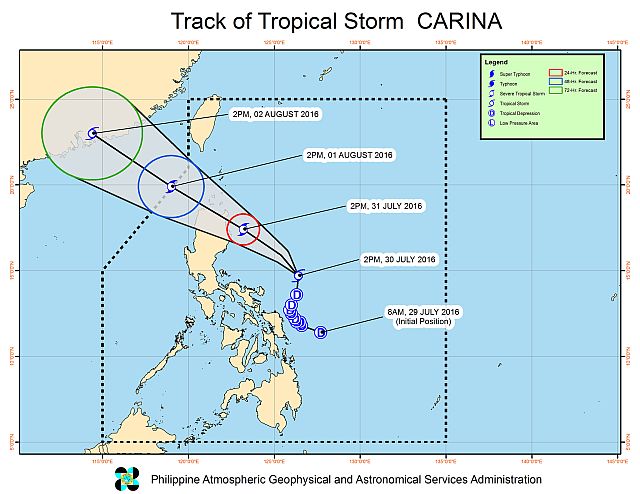
Carina is now spotted at 290 kilometers northeast of Catanduanes. It is expected to make a landfall in Tugegarao on Monday and exit the Philippine Area of Responsibility (PAR) on Tuesday.
Disclaimer: The comments uploaded on this site do not necessarily represent or reflect the views of management and owner of Cebudailynews. We reserve the right to exclude comments that we deem to be inconsistent with our editorial standards.