
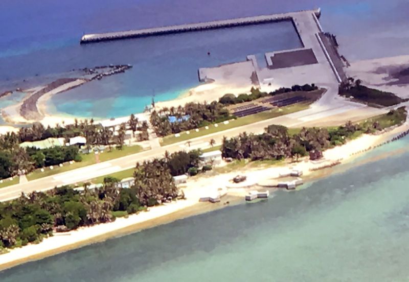
Taiwan-controlled Taiping Island is part of the Spratlys archipelago in the South China Sea. /AFP
Taipei — Taiwan’s defense ministry has asked Google to blur images of a new development believed to be for military use on a disputed South China Sea island.
Tensions remain high in the region over conflicting territorial claims, particularly over the strategically important Spratlys chain.
Taiwan administers Taiping island, which is the largest in the Spratlys archipelago. The island chain is also claimed in part or whole by the Philippines, Vietnam and China.
Google satellite images show a circular structure with four Y-shaped attachments, jutting out to sea on Taiping’s northwestern coast.
The development comes after Taiwan last year inaugurated a solar-powered lighthouse, an expanded airstrip and a pier as part of efforts to strengthen defense capabilities on Taiping.
The defense ministry said it was in the process of contacting Google Thursday to ask them to blur the satellite images but would not comment further on what the structures are.
“It is classified information,” the ministry’s spokesperson Chen Chung-chi said when asked the reason for the request to Google, which was made after images of the structures surfaced in local media.
Fears over possible military confrontation in the area have grown since an international tribunal ruling in July which rejected Beijing’s sweeping claims to almost all of the South China Sea — even waters approaching coasts of the Philippines and other Southeast Asian nations./AFP