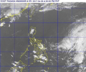
Pagasa satellite image.
Tropical Storm “Dante” maintained its strength as it continued to move northwest, the state weather bureau said on Wednesday afternoon.
In its 5 p.m. bulletin, the Philippine Atmospheric, Geophysical and Astronomical Services Administration (Pagasa) said Dante was last plotted at 1,105 kilometers east of Virac in Catanduanes as it moved northwest at 15 kilometers per hour (kph).
It was packing maximum sustained winds of 65 kph and gusts of up to 80 kph. No tropical cyclone warning signals have been raised so far.
Pagasa said easterlies were also affecting the eastern sections of the country.
Metro Manila and the rest of the country would experience partly cloudy to cloudy skies with isolated rainshowers or thunderstorms, it added.
“Light to moderate winds blowing from the east to southeast will prevail over Northern and Central Luzon and coming from the northeast to east over the rest of the country. The coastal waters throughout the archipelago will be slight to moderate,” Pagasa said.
Dante is forecast to leave the Philippine Area of Responsibility (PAR) on Friday morning. It is not forecast to make landfall or directly affect any part of the country.