
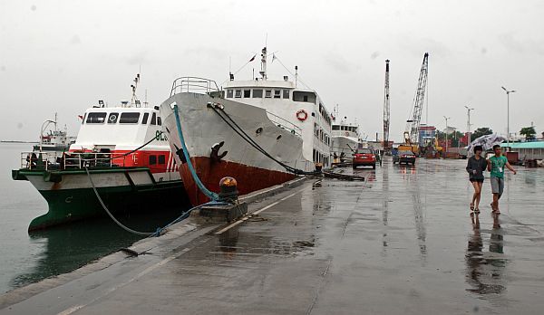
Small vessels are advised against sailing in today’s weather.
CDN File Photo
With typhoon “Paolo” (international name Lan) gaining strength, portions of Central Visayas will experience more rainfall and thunderstorms today until tomorrow.
Engineer Al Quiblat, weather analyst of the Mactan office of the state weather bureau Philippine Atmospheric Geophysical and Astronomical Services Administration (Pagasa) said “Paolo” was last spotted yesterday afternoon hovering 930 kilometers east of Baler, Aurora.
He said widespread light to moderate rains will prevail in Central, Western and Eastern Visayas until tomorrow. Waves will also rise 1.25 to 2.5 meters, Quiblat said.
“Because of the strong wind brought by Typhoon Paolo, we will have big waves and rough coastal waters in Cebu and the entire Central Visayas,” Quiblat said.
Small fishing vessels and ferries weighing less than 250 tons are advised against sailing to avoid accidents.
A gale warning was issued yesterday afternoon in the islands of Negros, Samar, Leyte and Siquijor.
Gale warnings are issued on maritime locations with winds blowing to up to 50 kilometers per hour, and waves reaching to up to 4.5 meters high.
Coast Guard officer Eljon Morilla said their office received notices from their substation in Dumaguete City canceling all trips.
“We’re giving owners of larger ships the discretion on whether or not to cancel their trips. But we have alerted them of big waves in the seas around Negros, Bohol, Siquijor, Negros, Samar, Zamboanga and Surigao,” Morilla said.
The LPA is projected to cross Palawan and reach Panay Island this afternoon.
The typhoon will exit the country tomorrow afternoon.