


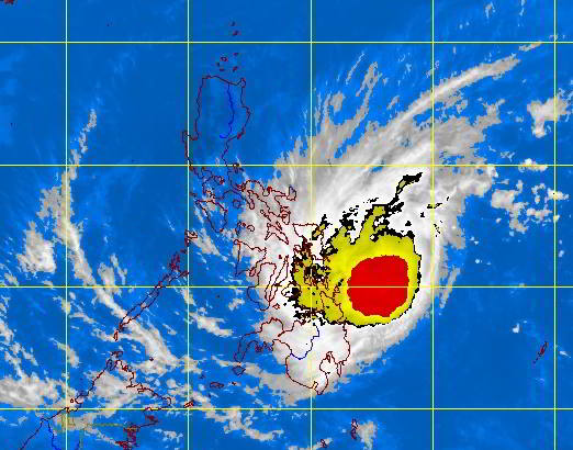
Tropical storm Basyang at 432 km East of Surigao City. (PAGASA SATELLITE IMAGE)
Tropical Depression Basyang (international name Sanba) maintained its strength as it is projected to make a third landfall in southern Cebu tonight.
The severe weather bulletin issued by the state weather bureau Pagasa at 5 p.m. Tuesday located the eye of Basyang at 25 kilometers southeast of Tagbilaran City in Bohol.
Cebu is still placed under Storm Signal No. 1.
The Following areas are still placed under Storm Signal no. 1: Palawan including Calamian and Cuyo groups of islands, Aklan, Capiz, Antique, Iloilo, Guimaras, Negros Occidental, Negros Oriental, Siquijor, Bohol, Cebu, Biliran, Leyte, and Southern Leyte, Camiguin, Misamis Oriental, Misamis Occidental, and northern section of Zamboanga del Norte.
Pagasa also issued a red rainfall warning in Cebu province which meant that rain pours at a rate of 15 to 30 millimeters per hour.
Pagasa-Mactan bureau chief, Engr. Al Quiblat, said Basyang is expected to barrel through southern Cebu at 4 p.m. to 7 p.m. tonight.
“Light to moderate rains with strong gusts of wind will be experienced, too. We cautioned local government units in the south to keep caution especially that Basyang will arrive during nighttime,” Quiblat said.
Basyang, the second major weather disturbance to enter the country this year, is packing winds of 65 kilometers per hour and is moving west at a speed of 27 kilometers per hour.