
MANILA, Philippines — Residents in Cagayan Valley region and Aurora province should brace themselves for a rainy Tuesday, as “Liwayway” has intensified into a tropical storm, according to the Philippine Atmospheric, Geophysical and Astronomical Services Administration (Pagasa).
The storm is still not expected to make landfall in the country before it exits the Philippine area of responsibility by Thursday.
Cloudy skies with scattered rain showers and thunderstorms are expected in these areas, the weather bureau said in its 4 p.m. bulletin on Monday. It added that occasional heavy rain may cause possible flash floods and landslides.
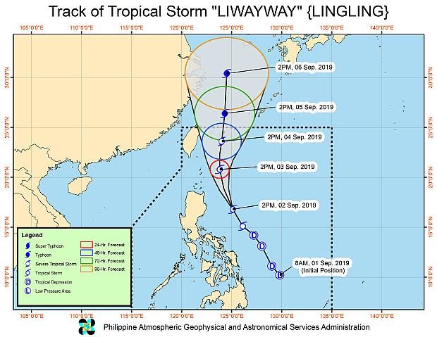
As of 3 p.m. on Monday, Liwayway’s center was 400 kilometers east northeast of Baler in Aurora, packing maximum sustained winds of 65 km per hour near the center and gusts of up to 80 kph.
Liwayway has slightly gained speed at 30 kph, but continues to move in the north-northwest direction.
As of 5 p.m. on Monday, Signal No. 1 had been raised over Batanes province.
Aside from the tropical storm, Pagasa is monitoring a new low pressure area that was spotted 490 km west of Iba, Zambales province, on Monday.
Cloudy skies with possible rainfall is expected across the country on Tuesday. The southwest monsoon will cause scattered rainfall and thunderstorms in Metro Manila, Calabarzon, Mimaropa, Bicol, Western and Central Visayas and Zamboanga Peninsula regions.
The same weather conditions are expected in the rest of Central Luzon, as well as in the provinces of Sulu, Tawi-Tawi and Basilan.
Localized thunderstorms, meanwhile, will bring isolated showers in the rest of the country.