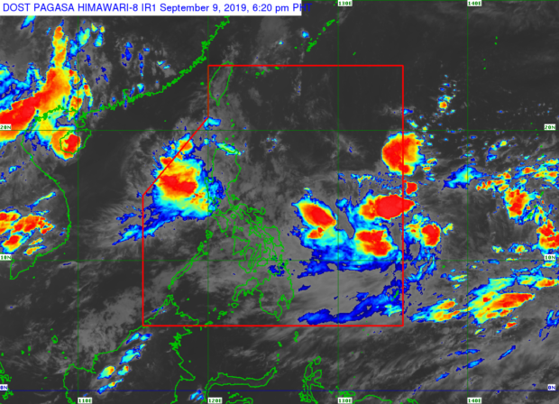
MANILA, Philippines — A low-pressure area (LPA) is expected to develop into a storm before entering the Philippine Area of Responsibility (PAR) by Wednesday, the Philippine Atmospheric, Geophysical and Astronomical Services Administration (Pagasa) said Monday.
The LPA is spotted outside PAR, 1,740 kilometers east of Southern Luzon, and is very likely to intensify into a storm in the next 36 to 48 hours. It will be named “Marilyn” as soon as it enters the country’s jurisdiction.
Meanwhile, another LPA spotted within PAR will have a low chance of developing into a storm, according to Pagasa.
As of 3 p.m., the LPA was spotted 580 kilometers northeast of Basco, Batanes and may exit PAR in the next few hours.
But a third LPA has been enhancing the southwest monsoon, the state weather bureau noted. It was spotted outside PAR – 405 kilometers of extreme northern Luzon.
Pagasa said the southwest monsoon will likely bring moderate to heavy rains over Ilocos Region, Cordillera Region, and Central Luzon while Cagayan Valley Region, Calabarzon, and Metro Manila will experience cloudy skies with scattered rain showers.
At 5 p.m., Pagasa raised a yellow rainfall warning in Zambales, Tarlac, and Pampanga.
A yellow warning means affected localities and populace should take caution as flooding is possible in low-lying areas and near river channels. /kga