
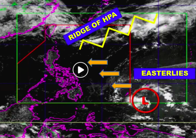
Satellite image of the Philippine Area of Responsibility (PAR) as of 4 p.m., May 7, 2020. |Photo courtesy of DOST-Pagasa
CEBU CITY, Philippines — A low-pressure area (LPA) is expected to enter the Philippine Area of Responsibility (PAR) between Thursday night, May 7, and Friday morning, May 8, 2020.
Angelica Orongan, a weather specialist at the Mactan Station of the Philippine Atmospheric Geophysical and Astronomical Services Administration (Pagasa), said once inside PAR, the LPA may bring rains to parts of the Visayas and Caraga region in Mindanao.
As of Pagasa’s 5 p.m. weather forecast, the center of the LPA was spotted about 1,145 kilometers east of Mindanao. The LPA is currently moving a west-northwest path.
READ: Pagasa spots cloud cluster east of Mindanao; is relief from heat coming?
However, the LPA remains to have low chances of developing into a typhoon, Orongan said.
“Sa pagkakaron dako ang posibilidad nga magdissipate siya like atong niagi nga LPA. So far, mao na atong nakita sa mga model karon,” Orongan explained.
At present, most parts of the country continue to experience hot and dry weather conditions. The ridge of a high-pressure area (HPA) extends over Northern and Central Luzon. Meanwhile, the Easterlies, bringing hot and dry winds from the Pacific, affects Visayas and Mindanao. /rcg