
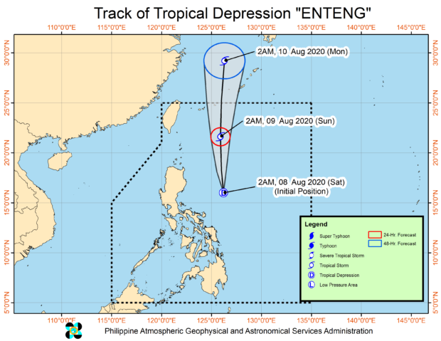
MANILA, Philippines – The low pressure area(LPA) east of the country has intensified into Tropical Depression Enteng early Saturday morning, the state weather bureau said in its 5 a.m. bulletin.
The Philippine Atmospheric, Geophysical, and Astronomical Services Administration (Pagasa) spotted “Enteng” 375 kilometers northeast of Virac, Catanduanes at 4 a.m.
“Enteng” packs a maximum sustained wind speed pf 45 kilometers per hour (kph) and gustiness of up to 55 kph and moving north at 10 kph.
No tropical cyclone wind signal has so far been raised.
The latest weather disturbance is expected to exit the Philippine area of responsibility by Sunday afternoon.
”Today, TD ENTENG will bring scattered light to moderate with at times heavy rains over Bicol Region and Eastern Visayas. The southwest monsoon enhanced by TD ENTENG will bring monsoon rains over Zambales, Bataan, Mindoro Provinces, Romblon, and Northern Palawan (including Calamian, Cuyo, and Kalayaan Islands) and occasional rains over Pangasinan, the rest of Central Luzon, Metro Manila, Calabarzon, the rest of Mimaropa, and the rest of Visayas,” Pagasa said in its latest severe weather bulletin.

Crewmen and operators of small vessels have been warned of moderate to rough sea conditions. / gsg