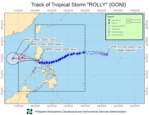
Image from Pagasa
MANILA, Philippines — Even as Tropical Storm Rolly continued to weaken over the West Philippine Sea, several areas in the country remained early on Monday under Tropical Cyclone Wind Signal No. 1 — including Metro Manila.
Rolly was located 100 km west southwest of Subic Bay, according to the 5 a.m. bulletin of the Philippine Atmospheric, Geophysical, and Astronomical Services Administration (Pagasa).
It had maximum sustained winds of 65 kph near the center with a gustiness reaching up to 80 kph as it moved west-northwest at 20 kph.
Tropical Cyclone Wind Signal No. 1 remained raised over the following areas:
- the northwestern portion of Occidental Mindoro (Paluan, Mamburao, Abra de Ilog) including Lubang Island
- the western portion of Batangas (Tingloy, Mabini, Bauan, San Luis, Taal, Agoncillo, San Nicolas, Santa Teresita, Talisay, Laurel, Lemery, Calaca, Balayan, Calatagan, Tuy, Lian, Nasugbu)
Extreme western portion of Laguna (San Pedro City, Biñan City) - Cavite
- Metro Manila
- the western portion of Bulacan (San Jose del Monte City, Santa Maria, Pandi, Bustos, Baliuag, Marilao, Meycauayan City, Obando, Bocaue, Bulacan, Balagtas, Guiguinto, Pulilan, Plaridel, Malolos City, Paombong, Hagonoy, Calumpit
- the western portion of Pampanga (San Luis, Mexico, Masantol, Sasmuan, Floridablanca, Lubao, Porac, Guagua, Santa Rita, Bacolor, Angeles City, Santo Tomas, San Fernando City, San Simon, Macabebe, Minalin, Apalit)
- Bataan
- the southern portion of Zambales (San Marcelino, San Felipe, San Narciso, San Antonio, Castillejos, Subic, Olongapo City)
Rolly is expected to exit the Philippine area of responsibility (PAR) on Tuesday morning.
Meanwhile, Pagasa warned against rough to very rough seas, with waves from 2.5 to 5.0 meters, over the seaboards of Northern Luzon and Central Luzon, the western seaboards of Batangas, Occidental Mindoro including Burias Island, and Calamian Islands, and eastern seaboards of Quezon including Polillo Islands and Bicol Region. / atm