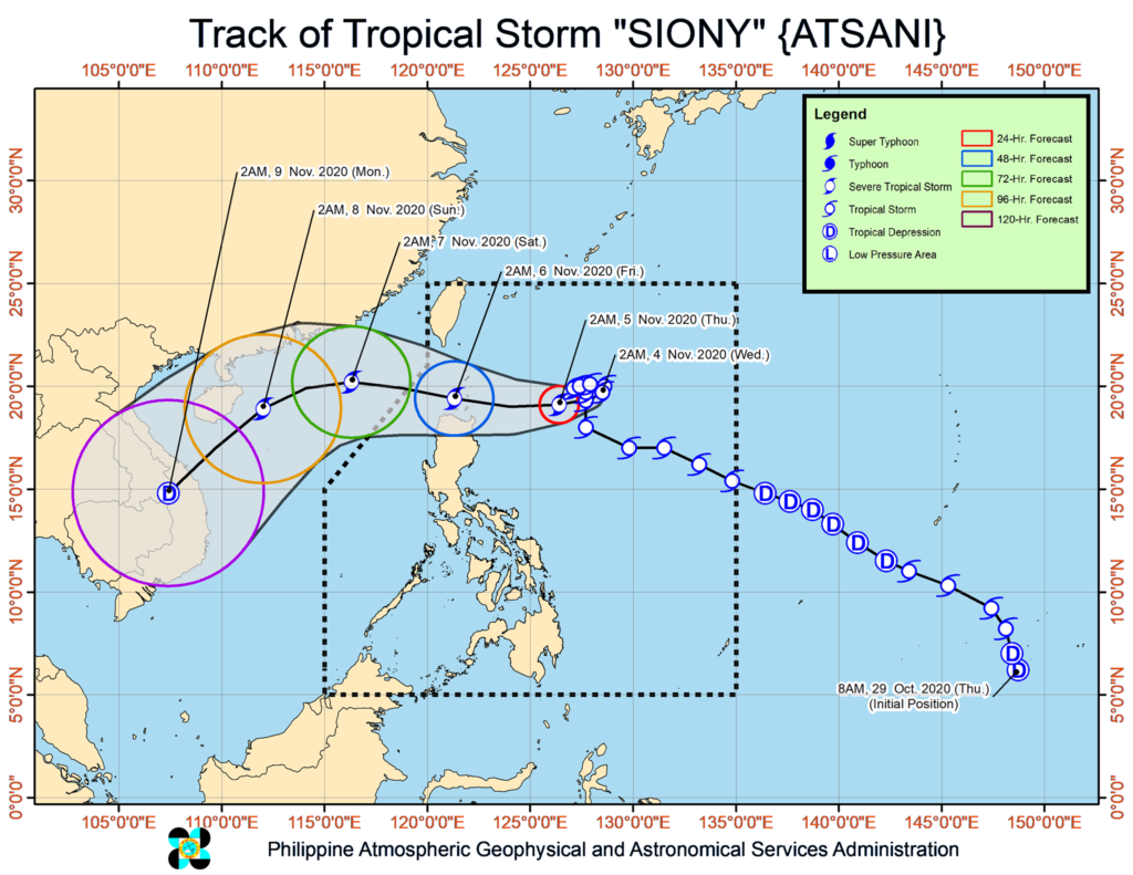
MANILA, Philippines — Tropical Cyclone Wind Signal (TCWS) No. 1 was raised over portions of Cagayan and Babuyan Islands due to Tropical Storm Siony (international name: Atsani), the state weather bureau said Wednesday, November 4, 2020.
In its 5 a.m. weather bulletin, the Philippine Atmospheric, Geophysical and Astronomical Services Administration (Pagasa) said that TCWS No. 1 is raised over the northeastern portion of mainland Cagayan (Santa Ana, Gonzaga) and the eastern portion of Babuyan Islands (Balintang Island, Babuyan Island, Didicas Island and Camiguin Island including their adjoining islets).
Under Pagasa’s public storm warning signal, TCWS No. 1 means that winds of 30-60 kilometers per hour (kph) may be expected in at least 36 hours or intermittent rains may be expected within 36 hours.
Based on Pagasa’s latest data, Siony was last spotted at 700 kilometers east of Basco, Batanes.
Siony also packed maximum sustained winds of 85 kph near the center, and gustiness of up to 105 kph.
The tropical storm was also spotted moving south-southwestward slowly.
State meteorologists said that Siony is forecast to move slowly or remain stationary in the next 12 hours, then may move generally westward or west-northwestward towards the Luzon Strait and Extreme Northern Luzon, bringing the tropical storm’s center over or very close to Batanes and Babuyan Islands between Thursday evening and Friday morning.
“As such, a landfall scenario over these localities remains likely,” Pagasa said.
Siony is also forecast to intensify to a severe tropical storm in the next 24 hours, Pagasa added.
Pagasa also said that the northeasterlies enhanced by Siony and Tropical Storm Rolly, which has left the Philippine Area of Responsibility, will bring strong breeze to gale-force winds with higher gusts over Batanes, Babuyan Islands, and the northern coastal areas of Cagayan and Ilocos Norte.
Tropical Storm Siony is expected to exit the Philippine Area of Responsibility on Friday afternoon or Friday evening.
