
MANILA, Philippines — Tropical Depression Ulysses is expected to continue intensifying and may even become a typhoon before it makes landfall somewhere over the Bicol Region probably on Wednesday.
This was the latest forecast issued Sunday night by the Philippine Atmospheric, Geophysical and Astronomical Services Administration (Pagasa).
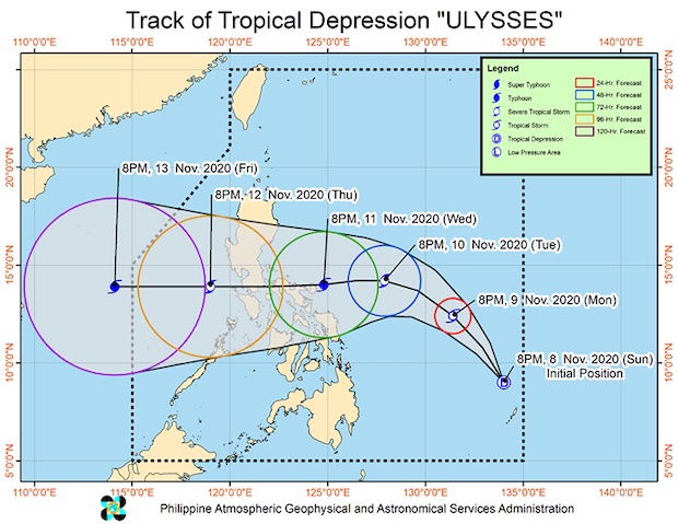
Ulysses was last located 800 km east of Hinatuan, Surigao del Sur, moving northwest at 15 kph.
According to Pagasa’s track prediction, Ulysses would make a northwest nudge after Monday night before moving west toward Camarines Sur province in the Bicol Region. A slight southwest turn would place it directly east of Catanduanes and Albay provinces.
All three areas — Camarines Sur, Albay, and Catanduanes — were pounded by Super Typhoon Rolly last Nov. 1, causing extensive infrastructure damage.
By Wednesday, just before hitting land, possibly in Catanduanes, it would have become a typhoon.
As of this writing, Ulysses was packing maximum sustained winds of 45 kph near the center with gustiness of up to 55 kph.
No tropical cyclone wind signals have been raised.
It also has no effect on the local weather at the moment. But starting on Tuesday or Wednesday, it may start to bring rains and winds over Eastern Visayas and Bicol.
Tropical Cyclone Wind Signal No. 1 may then be raised over some parts of those areas on Monday evening or Tuesday morning.
Pagasa advised residents in the possible path of Ulysses to continue monitoring its weather updates and coordinate with local disaster risk reduction offices to avoid casualties, especially as the areas mentioned were recently battered by Rolly. / atm