
image from Pagasa
CEBU CITY, Philippines—Tropical Storm Auring has not made landfall yet in Mindanao, but it has already started to affect the weather system in the country.
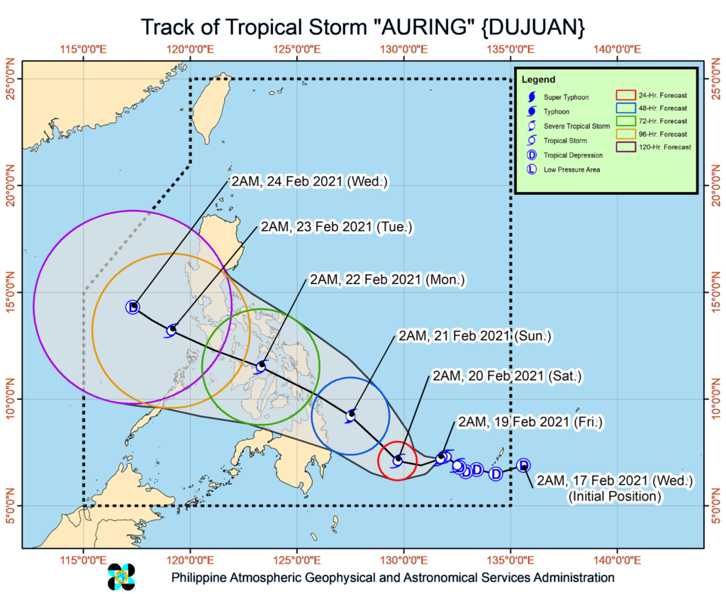
In the 5 a.m. forecast of the he Philippine Atmospheric, Geophysical and Astronomical Services Administration (PAGASA), the storm is said to be hovering almost stationary at sea, east of Mindanao.
The surge of the Northeast Monsoon is already bringing strong breeze to near-gale conditions with occasionally higher gusts over Northern Luzon and the eastern sections of Central Luzon, Southern Luzon, Visayas, and Mindanao, especially in coastal and mountainous areas.
With a maximum sustained winds of 75 kilometers per hour (km/h) near the center and gustiness of up to 90 km/h, Auring is expected to intensity into a Severe Tropical Storm in the next 48 hours.
However, the storm will likely weaken while crossing the archipelago due to significant terrain interaction and dry air intrusion from the Northeast Monsoon.
The storm will move generally westward or west-southwestward slowly over the next 24 hours before turning northwestward tomorrow morning while accelerating.
Auring is forecast to make landfall over the eastern coast of Caraga Region on Sunday, February 21, 2021.
On the forecast track, the storm will likely follow a generally northwestward path as it traverses Caraga Region, Visayas, and MIMAROPA on Sunday and Monday.
Parts of Mindanao has already been placed under Tropical Signal number 1 but none so far has been raised in Cebu or any portion of the Visayas islands.
/bmjo