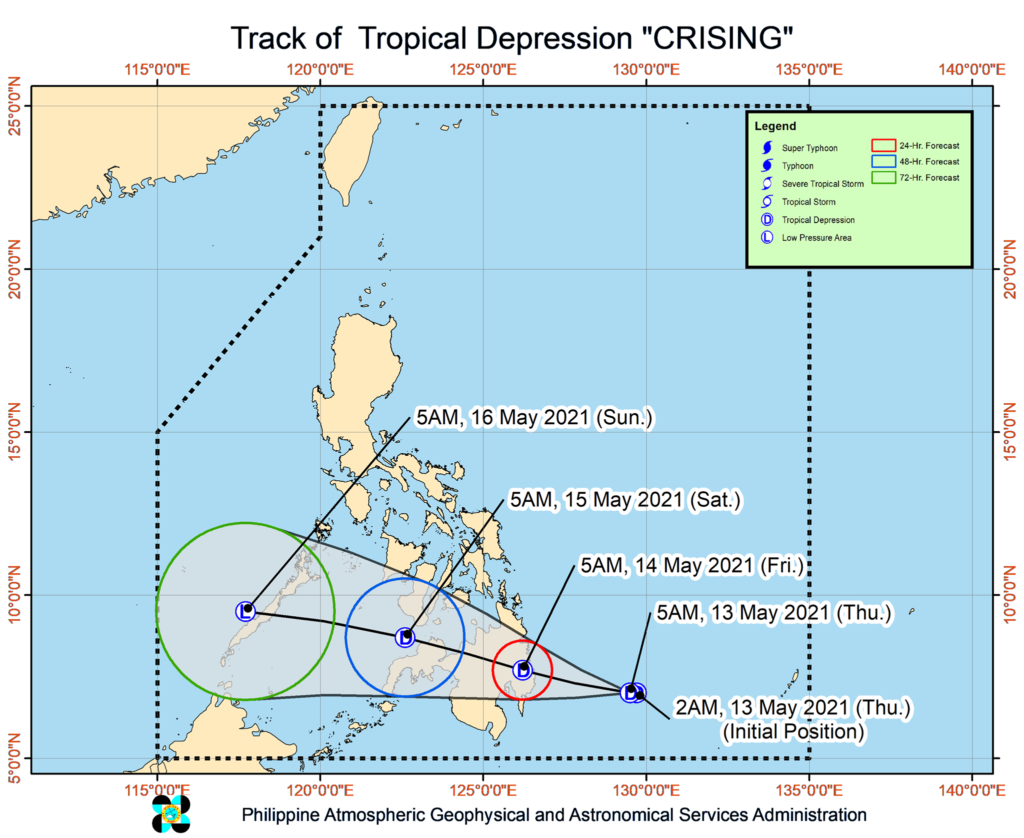
The track of TD Crising. | image from Dost_Pagasa
CEBU CITY, Philippines—Another major weather disturbance has entered the Philippine Area of Responsibility (PAR) and local state meteorologists forecasted it could bring rains in some parts of Cebu this weekend.
The Philippine Atmospheric Geophysical and Astronomical Services Administration in Mactan (Pagasa-Mactan) said central and southern Cebu may experience damp weather this Saturday, May 15, 2021, due to Tropical Depression Crising’s presence.
“If we’re going to look at our track, its path will directly affect Negros and Zamboanga areas. But its trough may affect the southern and central parts of Cebu, and may bring scattered rains this weekend,” said Romeo Aguirre, Pagasa-Mactan weather specialist, in Cebuano.
However, Aguirre said chances are high for Crising to weaken into a low-pressure area after emerging over Sulu Sea this Saturday.
“From what we’re seeing, Crising may either maintain its strength as a TD (while crossing most parts of Mindanao) or during landmass interaction, it will dissipate,” he explained.
Crising was last spotted 420 kilometers east of Davao City, packing maximum sustained winds of 45 kilometers per hour (kph) near the center and gusts of up to 55 kph.
Pagasa’s central office has already hoisted Tropical Cyclone Wind Signal (TCWS) No. 1 over four areas in Mindanao.
These are Surigao del Sur, Davao Oriental, Davao de Oro, and the eastern portion of Agusan del Sur (Prosperidad, San Francisco, Rosario, Bunawan, Trento, Santa Josefa, Veruela).
Crising is expected to move westward or west northwestward and is likely to make landfall over Surigao del Sur or Davao Oriental between Thursday night and early Friday.
Crising is forecast to weaken into a low pressure area after it emerges over the Sulu Sea early Saturday before leaving the Philippine area of responsibility. With reports from INQUIRER.NET
/bmjo