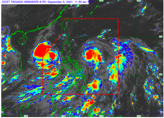

MANILA, Philippines — Typhoon Kiko (Chanthu) further intensified midday Thursday as it continues to move westward over the Philippine Sea.
The typhoon is packing maximum sustained winds of 195 kilometers per hour near the center and gusts of up to 240 km/h, the Philippine Atmospheric Geophysical and Astronomical Services Administration said.
Kiko, which was spotted 670 kilometers east of Baler, Aurora, is heading westward at 20 kilometers per hour (kph).
Signal No. 1 was raised over Cagayan including Babuyan Islands, the northeastern portion of Apayao (Luna, Pudtol, Flora, Santa Marcela), and the northeastern portion of Isabela (Santa Maria, San Pablo, Maconacon, Divilacan, Palanan).
An earlier forecast said Kiko, a potential super typhoon, could make landfall over the Babuyan Islands or mainland Cagayan.
Heavy to intense with at times torrential rains due to the typhoon may be experienced over Cagayan including the Babuyan Islands, and northern Isabela are expected starting Friday evening.
Moderate to heavy with at times intense rains may also be experienced over Batanes and the rest of Isabela.
In the next 24 hours, moderate to very rough seas will prevail over the eastern seaboard of Northern Luzon, Pagasa said.
All storm signals due to Tropical Storm Jolina were lifted as it continued to move away from the country.
RELATED STORY: ‘Kiko’ may intensify into supertyphoon as ‘Jolina’ moves to exit PAR