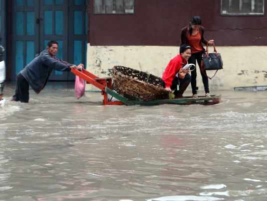
Mandaue City leads a list of 19 cities and municipalities in Cebu that are “highly susceptible” to flooding, according to a study by local government planners.
A total of 925 hectares or 31.76 percent of Mandaue City’s total land area of 2,912.50 hectares are “highly exposed to flooding”.
The Disaster Risk and Vulnerability Assessment Report of the Cebu Provincial Planning and Development Office (PPDO) was presented to officialsl yesterday.
“In the metropolitan cities of Cebu and Mandaue, floods are frequently caused by river flooding, riverine flooding or floods due to human activities that have altered the natural ground cover of a river basin and have increased the size and frequency of floods,” the report said.
Mandaue City is followed in the “highly susceptible” list by Pinamungajan town (2,204 hectares or 19.4 percent of the town’s total land area), Consolacion town (607 hectares or 13.5 percent of the total area); Talisay City (316 hectares of 7.3 percent of its total area), and Lapu-Lapu City (425 hectares or 7.1 percent of its total area).
The study said the flooded areas like Mandaue City, Cebu City and Balamban town are situated within or beside a river or creek systems or are in urban areas or places with highly impermeable surfaces (roofs and roads that inhibit infiltration) or areas with constricted river channels due to human activities (e.g. informal settlement, fish pen and fishpond, buildings and support structures creating temporary or permanent blockages).
Deforestation due to over logging and mining activities which resulted in a decrease in river channel capacities was also identified as among the causes of flooding.
Areas where there is steep topography, little vegetation and experience high-intensity rain are also susceptible to floods.
Highlights of the PPDO rpeort were presented at the Capitol Social Hall.
Explaining Cebu’s flood problem, the report said coastal floods are frequent as most town centers are located in low lying areas.
Mitigating measures for heavy rains and floods are needed when local officials craft their development plans, it said.
Last Wednesday, the Provincial Development Council chaired by Cebu Gov. Hilario Davide III approved a resolution endorsing the report to the Central Visayas Regional Development Council (RDC-7).
The report, according to PPDO executive assistant Melita Labarejos, was conceived in 2011, before the string of natural disasters that affected the Visayas like the Bohol earthquake and typhoon Yolanda.
Around 60 provinces entered into a memorandum of agreement (MOA) with the National Economic and Development Authority (Neda) for the project with the funding coming from United Nations Development Programme (UNDP) and Australian Aid (AusAID).
According to Labarejos, the data used in the report were provided by national line agencies such as the Department of Agriculture and the Department of Environment and Natural Resources.
Most of the data were illustrated in maps using a Geographical Information System (GIS), said Labarejos.
The report will be integrated to Cebu’s Provincial Physical Framework and Development Plan (PDPFP).
“This is still a work in progress. It took us three years since because it’s really trial and error,” Labarejos told Cebu Daily News.
Aside from the natural low-lying terrain of some coastal towns and cities, the report cited other factors the cause flooding.
For example, in Balamban town and in the cities of Mandaue and Cebu, flooding areas are usually situated within river or creek systems.
It also cited are urban areas or places with highly impermeable surfaces with roofs and roads that inhibit infiltration or areas with constricted river channels due to informal settlement other buildings and support structures creating temporary or permanent blockage.
The report also pointed to other human activities to cause the flooding deforested areas from over logging, mining activities resulting to decrease channel capacities and the shallowing and deposition of suspended sediments in plains and deltas.
The average of 19 typhoons visiting the province every year has also added to the case of flash floods, it said.
Records from the DENR Mines and Geosciences Bureau (MGB) show that rain-induced landslides left six people dead and 765 others injured while 129 houses totally destroyed in Cebu.
The report identified Cebu City as the most susceptible to landslides followed by Talisay City and Minglanilla due to its location in the central part of the province where steep mountain ranges are situated.
In Metro Cebu, “residential areas, school buildings, large institutions, roads and bridges, cell sites, health facilities, barangay centers, and public markets” are often affected by the landslides.
Baltazar Tribunalo, head of the Provincial Disaster Risk Reduction and Management Office, said the report will help local authorities in disaster situations since they already know the “vulnerable areas for each hazard.”
Aside from flooding and landslides, the report detailed the risk areas for storm surges, earthquakes, flash floods and sea level rise.
However, Tribunalo said barangay officials should come up with their own version of the report.
“At the macro level, it’s already there. But there should be a local hazard map for each municipality and city,” he said.
Related Stories:
Cebu City, Mandaue folks address flooding
Flooding in cities not good for Cebu’s investment climate
Classes in flood-prone Sapangdaku Elementary School
