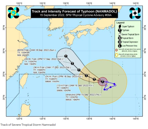

MANILA, Philippines — Severe Tropical Storm Namnadol is seen to enter the Philippine area of responsibility (PAR) by Thursday night and may strengthen into a typhoon, the state weather bureau said.
According to the Philippine Atmospheric Geophysical and Astronomical Services Administration (Pagasa), the center of Nanmadol was last located 1,760 kilometers east-northeast of extreme Northern Luzon, packing maximum sustained winds of 110 kilometers per hour (kph) and gustiness of up to 135 kph.
Once it enters PAR, Pagasa noted, Namnadol will be named “Josie.”
“On the track forecast, it may enter the [PAR] region tonight or tomorrow morning,” the state weather service said. “Nanmadol is forecast to reach typhoon category within 12 to 24 hours.”
Nanmadol is far from the country’s landmass, Pagasa said, but it will enhance the southwest monsoon – locally termed “habagat” – thus, rain may be anticipated over several parts of the country.
“This severe tropical storm is forecast to remain far from the Philippine landmass and not directly affect the weather condition in the country. However, the Southwest Monsoon enhanced by Nanmadol will bring monsoon rains over the western sections of Southern Luzon, Visayas, and Mindanao,” Pagasa said.
RELATED STORY
Pagasa: ‘Nanmadol’ intensifies into severe tropical storm outside PAR
KGA
Click here for more weather related news.