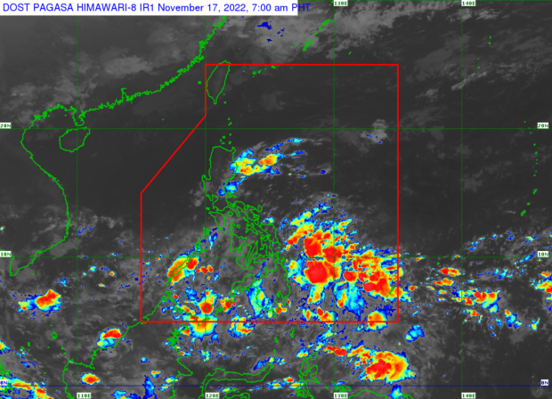

MANILA, Philippines — The intertropical convergence zone (ITCZ) and the trough of a low pressure area (LPA) will trigger rain in Mindanao and other parts of the country on Thursday, November 17, 2022, said the state weather bureau.
According to the Philippine Atmospheric, Geophysical and Astronomical Services Administration (Pagasa), the LPA is 200 kilometers south southeast of General Santos City, outside the Philippine area of responsibility. The LPA has a low chance of becoming a tropical cyclone, it said.
“Asahan natin na within the next 24 hours, ang pinagsamang epekto nitong ITCZ at nitong trough o extension nitong low pressure area ay magdadala ng maulap na kalangitan at kalat-kalat na pag-ulan, pagkulog, pagkidlat, sa bahagi ng buong Mindanao, dito sa Palawan, sa malaking bahagi ng Visayas at sa Bicol Region,” said Pagasa weather specialist Daniel James Villamil.
(We expect that within the next 24 hours, the combined effects of the ITCZ and the trough or extension of the low pressure area will bring cloudy skies and scattered rain, thunder and lightning in all of Mindanao, here in Palawan and a large part of Visayas and the Bicol Region).
Meanwhile, Pagasa said that the shear line is affecting Quezon, Aurora, Isabela, and mainland Cagayan, causing cloudy skies and rain.
For Metro Manila and the rest of the country, there will be partly cloudy to cloudy skies with rain due to localized thunderstorms, said the state weather bureau.
Areas affected by heavy rain are warned by Pagasa of possible flash floods and landslides. No gale warnings are raised, however.
Pagasa listed these temperature ranges for Thursday:
- Metro Manila — 25 to 33 degrees Celsius
- Baguio — 15 to 25 degrees Celsius
- Laoag — 23 to 33 degrees Celsius
- Tuguegarao — 23 to 31 degrees Celsius
- Legazpi — 25 to 29 degrees Celsius
- Puerto Princesa — 29 to 32 degrees Celsius
- Tagaytay — 21 to 31 degrees Celsius
- Kalayaan Islands — 26 to 32 degrees Celsius
- Iloilo — 26 to 31 degrees Celsius
- Cebu — 26 to 30 degrees Celsius
- Tacloban — 25 to 31 degrees Celsius
- Cagayan de Oro — 24 to 30 degrees Celsius
- Zamboanga — 24 to 33 degrees Celsius
- Davao — 24 to 32 degrees Celsius
RELATED STORIES:
LPA spotted near Mindanao, low chance of becoming a cyclone — Pagasa
Pagasa: Fair, hot and humid Good Friday weather