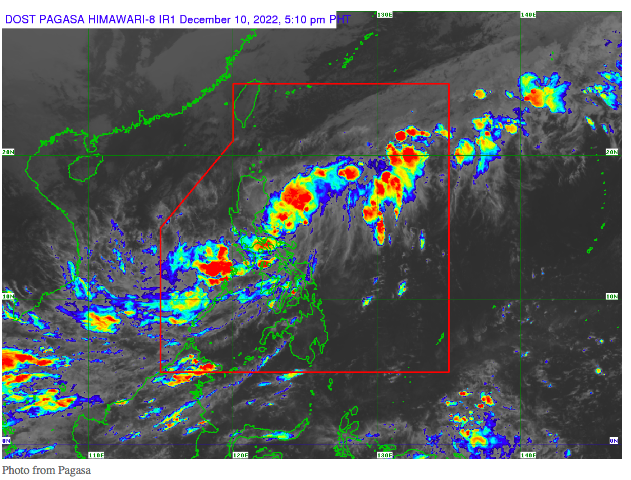
MANILA, Philippines — Tropical Depression Rosal maintained its strength as it moved north-northwestward over the Philippine sea, said the Philippine Atmospheric, Geophysical and Astronomical Services Administration (Pagasa) in its Saturday afternoon update.
Signal Number 1 remains hoisted over the northern portion of Catanduanes (Pandan, Gigmoto, Bagamanoc, Panganiban, Viga, Caramoran), said Pagasa.
“Areas under Tropical Cyclone Wind Signal no. 1 may experience strong winds (strong breeze to near gale strength) associated with Tropical Depression ‘Rosal,’” said Pagasa’s advisory.
Rosal is currently 285 kilometers east of Infanta, Quezon, with maximum sustained winds of 45 kilometers per hour and gustiness of 55 kilometers per hour, said state meteorologists.
Pagasa also stated that the Bicol Region, Mimaropa, Western Visayas, and Quezon can still expect moderate with at times heavy rains due to the effects of Rosal.
“Under these conditions, flooding and rain-induced landslides are expected, especially in areas that are highly or very highly susceptible to these hazards as identified in hazard maps and in localities with significant antecedent rainfall,” Pagasa said regarding the areas affected by Rosal’s rains.
Meanwhile, Metro Manila, parts of Cagayan Valley, Aurora, Calabarzon, Mimaropa, and Visayas are forecast to experience the combined effects of Rosal’s extension and the shear line, said Pagasa. Cloudy skies with scattered rain are set to prevail in these areas.
According to Pagasa, Rosal is expected to intensify over the Philippine Sea, reaching tropical storm level. However, it may meet with the northeast monsoon or “amihan,” causing it to weaken into a tropical depression again by Monday.
RELATED STORIES
Signal No. 1 in 3 parts of Bicol due to Tropical Depression Rosal
Pagasa says rain likely this weekend due to LPA that may turn into storm