


| Pagasa
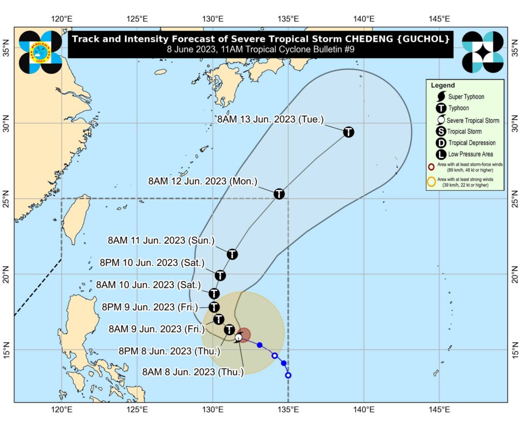
Severe Tropical Storm #ChedengPH (International name: GUCHOL) has intensified while moving west northwestward over the Philippine sea on Thursday, June 8, 2023, Pagasa said.
The location of the center of Chedeng was estimated at 1,070 kilometers east of Central Luzon.
It has maximum sustained winds of 100 kilometers per hour (km/h) near the center, gustiness of up to 125 km/h, and central pressure of 985 hPa. It is moving west northwestward at 15 km/h.
READ: Tropical Storm Chedeng – live updates
Chedeng is unlikely to directly bring heavy rainfall over any portion of the country in the next three to five days, Pagasa said.
Chedeng will remain far from the Philippine landmass and is forecast to move generally west northwestward to northwestward on Thursday through Friday before turning more northward on Friday evening.
“Owing to favorable environmental conditions, Chedeng is forecast to intensify in the next two to three days and may be upgraded into a typhoon by Thursday night or Friday. Peak intensity may be reached by Saturday,” Pagasa said in its 11 a.m. advisory.