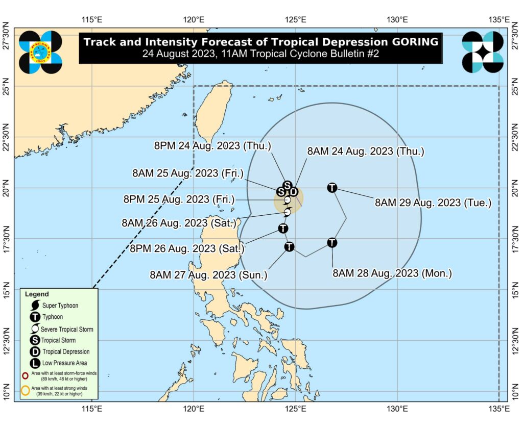
Pagasa image
Tropical Depression Goring maintained its strength as it moves north northwestward over the Philippine Sea east of Batanes late Thursday morning, August 24, 2023.
Based on a bulletin issued at 11 a.m., the location of the center of Goring was 355 kilometers east northeast of Calayan, Cagayan, or 300 km East of Basco, Batanes.
It brings with it maximum sustained winds of 55 km/h near the center, gustiness of up to 70 km/h, and central pressure of 1004 hPa, the bulletin said.
READ: LIVE UPDATES: TD Goring
Goring is moving north northwestward at 15 km/h.
No Wind Signal is hoisted as of this posting.
According to Pagasa, TD Goring is less likely to bring heavy rainfall over the country in the next three days.
However, considering the proximity of the tropical cyclone to land, any westward shift in the track forecast may result in heavy rainfall over portions of Cagayan Valley in the next three days. As such, the public and disaster managers are advised to continue monitoring for updates.
The Southwest Monsoon may be enhanced by this tropical cyclone beginning on Sunday or Monday, resulting in possible occasional rains over the western portions of Central and Southern Luzon.
The current forecast scenario shows that hoisting of Tropical Cyclone Wind Signals over areas in Northern Luzon may begin tonight or tomorrow in anticipation of the onset of tropical cyclone severe winds, Pagasa said in its bulletin no. 2 for TD Goring.