Pagasa
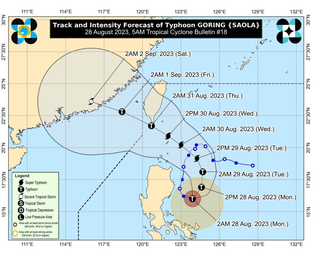
MANILA, Philippines — After weakening into a typhoon status on Monday, Goring is likely to return to the super typhoon category on Tuesday, state meteorologists said.
In its latest advisory, the Philippine Atmospheric, Geophysical and Astronomical Services Administration (Pagasa) said Goring downgraded to typhoon category at around 2:00 am on Monday and will become a super typhoon again at 2:00 pm on Tuesday.
“Goring is forecast to slightly weaken further in the next 12 hours due to upwelling of cooler ocean waters and onset of dry air intrusion before re-intensifying as it turns northwestward,” Pagasa said.
“It may be upgraded again to super typhoon category by mid tomorrow,” it added.
According to Pagasa, Goring’s center is currently located 210 kilometers east of Casiguran, Aurora, packing maximum sustained winds of 175 kilometers per hour (kph) near the center with gustiness of up to 215 kph.
Here are the areas under TCWS No. 1, where winds of 39-61 kph or intermittent rains may be expected within 36 hours: Batanes, Babuyan Islands, the northern and eastern portions of mainland Cagayan, the eastern portion of Isabela, the northern and central portions of Aurora, Polillo Islands, the northern and eastern portions of Camarines Norte including Calaguas Islands, the northeastern portion of Camarines Sur and the northern portion of Catanduanes.
Meanwhile, Pagasa said higher TCWS may still be hoisted over extreme northern Luzon and the northern or northeastern portion of mainland Cagayan by Monday or Tuesday, while raising of Wind Signal No. 3 or 4 over the Batanes-Babuyan Islands area is not ruled out.
READ MORE:
Goring now a super typhoon, storm signals up over 19 areas in Luzon — Pagasa