
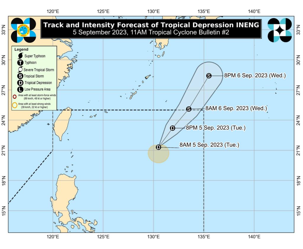
The track and intensity forecast of tropical depression Ineng. | Pagasa image
Tropical Depression Ineng maintained its strength while moving westward on Tuesday morning, September 5, 2023.
Based on its 11 a.m. bulletin, Pagasa, the state weather bureau, said Ineng has maximum sustained winds of 45 kilometer per hour (km/h) near the center, gustiness of up to 55 km/h, and central pressure of 1002 hectopascal (hPa).
READ: LPA develops into Tropical Depression Ineng
The center of tropical depression Ineng as of 10 a.m. was at 975 km east of extreme northern Luzon, moving westward slowly.
Pagasa said strong winds extend outwards up to 150 km from the center.
As of this posting, no wind signal has been hoisted.
The tropical depression is not directly affecting the country, although it is slightly enhancing the southwest monsoon.
The enhanced monsoon will bring occasional to monsoon rains over the western portions of Luzon in the next three days.
The tropical depression is forecast to remain far from the Philippine landmass. Tracking generally northeastward or north northeastward while gradually intensifying throughout forecast period, it may exit the Philippine Area of Responsibility Tuesday night or Wednesday as a tropical storm.
Outside the PAR region, it will continue in its northeastward or north northeastward movement towards the waters south of mainland Japan.