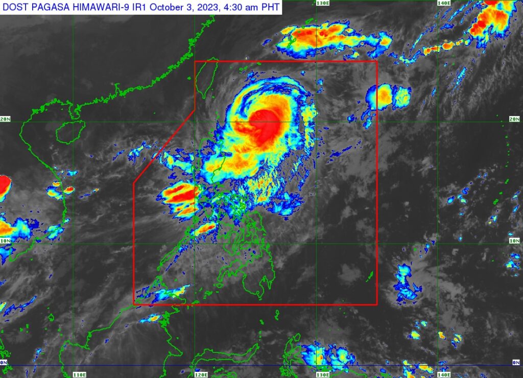
Typhoon Jenny’s satellite image.| Pagasa
Typhoon Jenny (International name Koinu) maintained its strength over the Philippine Sea based on the 5 a.m. bulletin of Pagasa on Tuesday, October 3, 2023.
Jenny packs maximum sustained winds of 165 kilometers per hour (km/h) near the center, gustiness of up to 205 km/h, and central pressure of 945 hPa.
READ: Typhoon Jenny: LIVE UPDATES
The location of Jenny’s eye as of 4 a.m. on Tuesday was at 350 kilometers east of Basco, Batanes. It is moving west northwestward at 15 km/h.
Signal no. 2 is in effect in Batanes while Signal no. 1 is raised in these areas: Cagayan including Babuyan Islands, the northern and eastern portions of Isabela (Maconacon, Divilacan, Palanan, Santa Maria, San Pablo, Tumauini, Cabagan, Ilagan City, San Mariano, Santo Tomas, Dinapigue, Benito Soliven, Naguilian, Gamu, Quirino, Delfin Albano, Quezon, Mallig), Apayao, the northeastern portion of Abra (Tineg, Lacub, Malibcong), the northern portion of Kalinga (Balbalan, Pinukpuk, Rizal, City of Tabuk), and Ilocos Norte.
Jenny is forecast to move northwestward or west northwestward until Wednesday morning or afternoon before turning generally westward thereafter.
On the track forecast, Jenny will make landfall over the southern portion of Taiwan between late evening Wednesday or Thursday morning then exit the Philippine Area of Responsibility (PAR) between Thursday morning and afternoon.