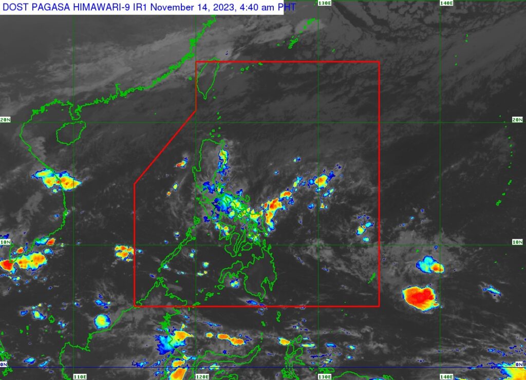
Satellite image of Pagasa shows that the tropical depression east of Mindanao has weakened into a LPA.
The tropical depression east of southeast Mindanao has weakened into a low-pressure area (LPA) based on the latest advisory from the Philippine Atmospheric Geophysical and Astronomical Services Administration (Pagasa) on Tuesday, November 14, 2023.
The location of the center of the LPA is estimated, based on all available data, at 1,620 kilometers East of Southeastern Mindanao, which is still outside of the Philippine Area of Responsibility (PAR).
READ MORE: Tropical depression may become typhoon by Saturday, to affect VisMin area
The advisory said the LPA has a central pressure of 1006 hPa and is moving south southwestward at 10 kilometers per hour (km/h).
“This Low Pressure Area is forecast move erratically and may meander near or around its present position in the next 24 hours as it remains highly disorganized. Unfavorable environment may prevent this weather disturbance from significantly organizing during the same period,” the advisory said.
‘Kabayan’
The advisory also said that a slight improvement in the environmental conditions will allow this disturbance to reorganize and re-develop into a tropical depression.
During the same period, the system is forecast to accelerate towards the west or west northwestward is forecast to occur. It may enter the PAR region late Wednesday or early Thursday.
Should the disturbance re-develop within or enter the PAR as a tropical depression, the domestic name “KABAYAN” will be assigned to it, the advisory said.
Within the PAR, this weather system will continue tracking westward until Friday while slowly intensifying. A more northwestward turn during the weekend over the waters east of Mindanao.
“Regardless of its development trend, the interaction between this disturbance and a possible shear line related to the forecast surge of the Northeast Monsoon may result in heavy rainfall over the eastern portion of Mindanao beginning on Friday and over Bicol Region and most of Visayas (especially the eastern portion) beginning on Saturday,” the Pagasa advisory explained.