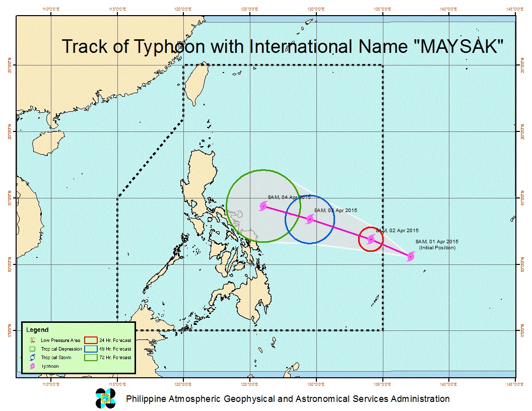
While typhoon Maysak continued to intensify as it neared the Philippine area of responsibility (PAR), the weather bureau yesterday said the cyclone would not hit the country as a supertyphoon.
The typhoon which will be named Chedeng when it enters the PAR late Wednesday or early Thursday, will weaken as it nears the Luzon landmass, according to the Philippine Atmospheric Geophysical Astronomical Services Administration (Pagasa).
“It may further intensify but while it nears land, it will weaken,” Pagasa meteorologist Shelly Ignacio said.
“We will not be hit by a supertyphoon,” she added. Pagasa said the vertical wind shear over Luzon would weaken the incoming cyclone.
As of Tuesday, March 31, typhoon Maysak packed maximum sustained winds of 175 kilometers per hour and gusts of up to 210 kph while about 1,700 kilometers east of northern Mindanao.
Pagasa considers a cyclone a supertyphoon if its sustained winds reach at least 220 kph.
Moving west northwest at 20 kph, Pagasa said the typhoon has been heading to Luzon, as of Tuesday, and has been projected to make landfall over northern or central Luzon by weekend.
According to PAGASA, the typhoon will affect the eastern section of Luzon.
Ignacio said while the typhoon has been forecast to enter the PAR either late Wednesday or early Thursday, its effects would not be felt until Friday, April 3.
The Bicol region will experience rains, but not stormy weather, by Friday before the cyclone affects the northern and central Luzon for the rest of the weekend, according to Ignacio.
Interior and Local Government Secretary Mar Roxas ordered local government units in the Visayas and Southern Luzon to make necessary preparation for typhoon Chedeng.