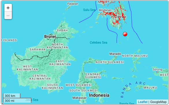
Photo is a map from the Phivolcs showing where the earthquake struck. | Phivolcs
A 6.7 magnitude earthquake struck in the Pacific Ocean early Tuesday off the coast of the Philippines, the US Geological Survey said.
The quake did not trigger a tsunami alert, according to the US Tsunami Warning System and there were no immediate reports of major damage or injuries.
READ: EXPLAINER: Earthquake terms you need to know
Quake struck at depth of 70 km
It struck at a depth of 70 kilometers (43 miles) about 100 kilometers from Sarangani at the tip of the southern island of Mindanao, the USGS said.
This was confirmed by Philippine Institute of Volcanology and Seisomology (Phivolcs) in its latest earthquake bulletin, where it put the time the earthquake struck at 4:48 a.m.
According to 4:48 a.m. Phivolcs bulletin, it was felt at intensity 4 in Sarangani.
READ: Powerful earthquake rocks Japan, nearly 100,000 residents ordered to evacuate
119 kilometers south of Sarangani
Phivolcs said that the temblor struck 119 kilometers south of Sarangani.
It also said that the quake would not cause damage but aftershocks would be felt.
Phivolcs also described the cause of the quake as tectonic.
READ: Japan quake: Snow hampers rescues, aid
Quakes in PH
Most are too weak to be felt by humans.
Last month a 7.6 magnitude quake struck off Mindanao, briefly triggering a tsunami warning. At least three people died.| With Phivolcs report
READ: Earthquake: Cebuanos told to start preparing for it