
Weather satellite image from Pagasa
MANILA, Philippines — The trough of Severe Tropical Storm Bebinca and the southwest monsoon is expected to bring cloudy skies and rains on Thursday in most of the country.
That is according to the state weather bureau.
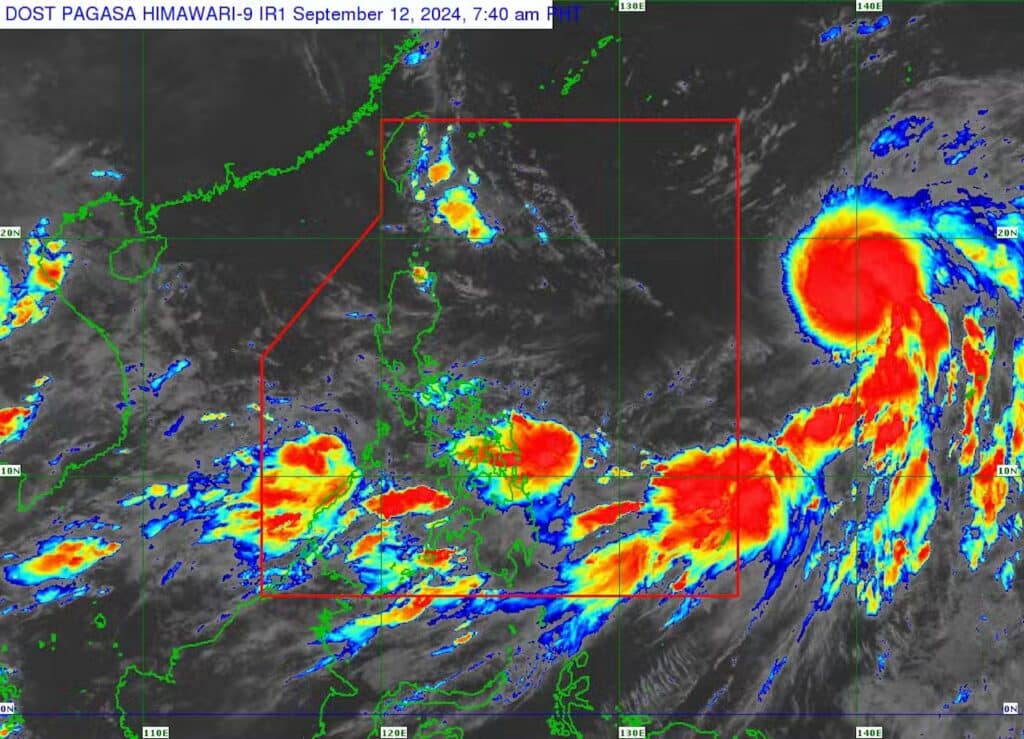
Based on its last tracking, Bebinca was 1,975 kilometers east of Central Luzon – outside the Philippine area of responsibility (PAR), packing maximum sustained winds of 95 kilometers per hour (kph) with gustiness of 115 kph, said Philippine Atmospheric, Geophysical and Astronomical Services Administration (Pagasa).
“Asahan na po ang pag-ulan ngayong araw at sa mga susunod pa na araw sa malaking bahagi ng Luzon, Visayas, and Mindanao,” Pagasa specialist Benison Estareja said during Thursday morning’s public weather report.
(Let’s now expect rains today and in the coming days in most parts of Luzon, Visayas and Mindanao.)
READ MORE:
EXPLAINER: What do color-coded rainfall warnings mean?
Cloudy Wednesday (Sept 11) with a chance of rain in parts of PH
‘Bebinca’ to enhance habagat, rains in Cebu expected in next 4 days
The trough or extension of Bebinca will bring cloudy skies with scattered rain showers and thunderstorms to Eastern Visayas, Caraga Region, Catanduanes, Albay, Sorsogon, and Masbate, according to Estareja.
The southwest monsoon, locally termed habagat, meanwhile, was forecast to cause overcast skies with scattered rain showers and thunderstorms in the rest of Visayas and Mindanao, as well as Palawan, Occidental Mindoro, and Romblon on Thursday.
As for Metro Manila and the rest of the country, partly cloudy to cloudy skies with chances of isolated rain showers could be expected Thursday, Estareja added.
Estareja noted that Bebinca may intensify into a typhoon before entering the PAR on Friday night.
READ MORE: Tropical depression intensifies into tropical storm Bebinca outside PAR
Once Bebinca enters PAR, it would be locally named Ferdie and the sixth tropical cyclone to hit the country.
“Inaasahan na kikilos ito pa-hilagang-kanluran pa rin hanggang makalabas agad ng PAR sa Sabado ng umaga,” he said.
(It is expected to move northwest until its leaves PAR on Saturday morning.)
Pagasa did not raise any gale warnings over any seaboards nationwide for September 12.