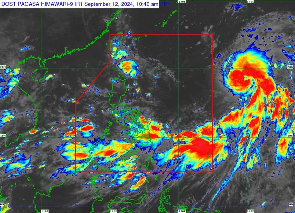
Satellite image of Severe Tropical Storm Bebinca as of September 12, 2024 | Photo from Pagasa
CEBU CITY, Philippines – Severe Tropical Storm Bebinca is forecasted to enter the Philippine Area of Responsibility (PAR) by Friday, September 13, 2024, the state weather bureau said.
The Philippine Atmospheric Geophysical and Astronomical Services Administration (Pagasa) on Thursday, September 12, said Bebinca has maintained its strength as it makes it way northward over the Philippine Sea outside the PAR.
It packed winds with speeds of winds of 95 kilometers per hour (kph) near the center, and gustiness of up to 115 kph.
The severe tropical storm is expected to enter PAR between Friday afternoon and evening. Bebinca will also likely remain far from the Philippine landmass, Pagasa added.
“(Bebinca) will exit the PAR region tomorrow late evening or Saturday morning,” they said.
However, Bebinca has intensified the prevailing southwest monsoon, locally known as habagat, and will likely bring heavy rains and strong winds until this weekend in many parts of the country, including Cebu.
RELATED STORIES
‘Bebinca’ to enhance habagat, rains in Cebu expected in next 4 days
Tropical depression intensifies into tropical storm Bebinca outside PAR
Additionally, Pagasa said the enhanced habagat will bring moderate to rough seas in the next 24 hours over the eastern seaboard of Mindanao, the western seaboard of Palawan including Kalayaan Islands, the western seaboard of Visayas, the eastern seaboard of Palawan, the western seaboard of Mindanao, and the southern and eastern seaboards of Visayas.
In these areas, waves reaching a height of up to 3.5 meters tall are expected.
“Mariners of small seacrafts, including all types of motorbancas, are advised not to venture out to sea under these conditions, especially if inexperienced or operating ill-equipped vessels,” they added.
The center of Bebinca was last spotted 1,975 kilometers East of Central Luzon and 1,930 kilometers East of Northern Luzon. It is moving at a west northwestward direction with speeds of 25 kph.