
earth.null
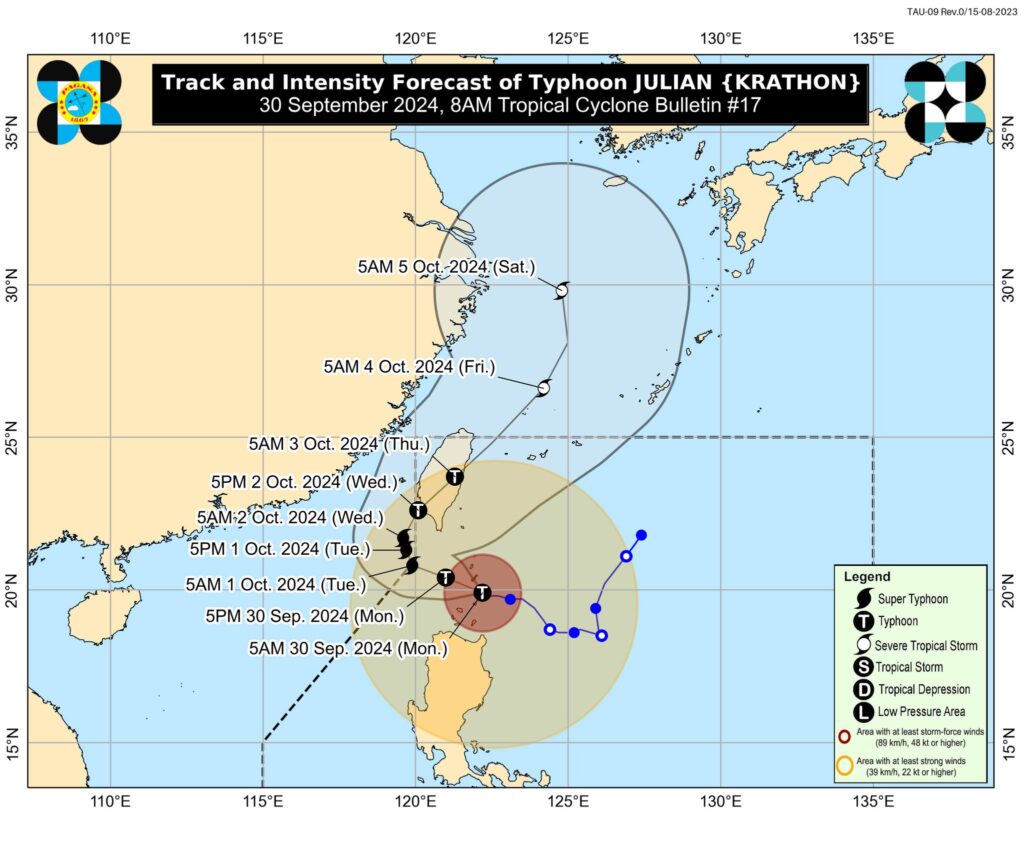
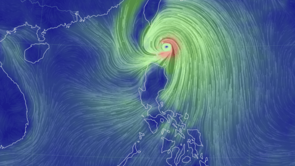
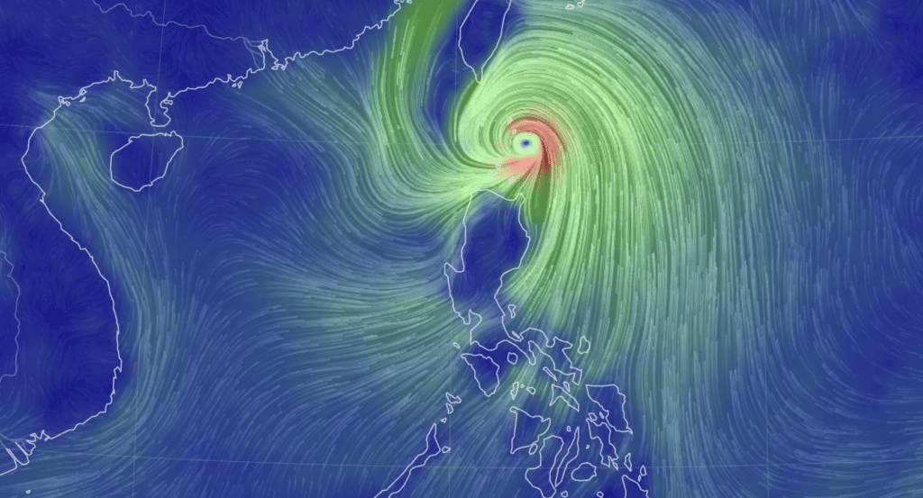
Typhoon #JulianPH (international name: KRATHON) further intensified and is nearing super typhoon category, according to the latest bulletin of Pagasa on Monday morning, September 30, 2024.
Based on data from 7 a.m., Julian packs maximum sustained winds of 175 kilometers per hour (km/h) near the center, gustiness of up to 215 km/h, and central pressure of 940 hPa.
The location of the eye of typhoon Julian as of 7 a.m. was estimated over the coastal waters of Balintang Island, Calayan, Cagayan.
READ MORE:
Severe storm Julian intensifies, signal no. 3 up in Babuyan Islands
Storm Helene: Death toll soars in US, North Carolina reeling
The typhoon is moving west northwestward at 10 km/h.
Typhoon Julian: TROPICAL CYCLONE WIND SIGNALS (TCWS) IN EFFECT
Signa No. 4
Luzon
Batanes and the northern portion of Babuyan Islands (Babuyan Is., Calayan Is.)
(Range of wind speeds: 118 to 184 km/h; Beaufort 12)
Signal no. 3
Luzon
The rest of Babuyan Islands and the northeastern portion of mainland Cagayan (Santa Ana)
(Range of wind speeds: 89 to 117 km/h; Beaufort 10 to 11)
Signal No. 2
Luzon
The rest of mainland Cagayan, Apayao, northern portion of Abra (Tineg, Lacub, Malibcong, Licuan-Baay, San Juan, Lagayan, Lagangilang, Dolores, Daguioman, Danglas, La Paz), northern portion Kalinga (Pinukpuk, Balbalan, City of Tabuk, Rizal), Ilocos Norte, and the northern portion of Ilocos Sur (Sinait, Cabugao)
(Range of wind speeds: 62 to 88 km/h; Beaufort 8 to 9)
Signal No. 1
The rest of Ilocos Sur, La Union, Pangasinan, the rest of Abra, the rest of Kalinga, Ifugao, Mountain Province, Benguet, Isabela, Nueva Vizcaya, Quirino, Aurora, the northern and eastern portions of Nueva Ecija (Cuyapo, Rizal, Laur, Pantabangan, Science City of Muñoz, Gabaldon, Carranglan, San Jose City, Lupao, Talugtug, Bongabon, Llanera, Talavera, Palayan City, General Mamerto Natividad), and Polillo Islands
(Range of wind speeds: 39 to 61 km/h; Beaufort 6 to 7)
Julian: TRACK AND INTENSITY OUTLOOK
Typhoon Julian is forecast to move generally west northwestward over the Balintang Channel on Monday and pass very close to Balintang Island and Batanes. A landfall scenario over these areas remains likely. Nevertheless, this typhoon will be at its closest to Batanes and Babuyan Islands this morning through afternoon.
According to Pagasa, the typhoon will begin recurving Tuesday, October1 , while moving slowly, then turn generally northeastward on Wednesday towards the southwestern coast of Taiwan, where it is forecast to make landfall on Wednesday morning or afternoon. Typhoon Julian will continue intensifying and may reach super typhoon category Tuesday at the start of its recurvature.