pagasa.dost.gov.ph
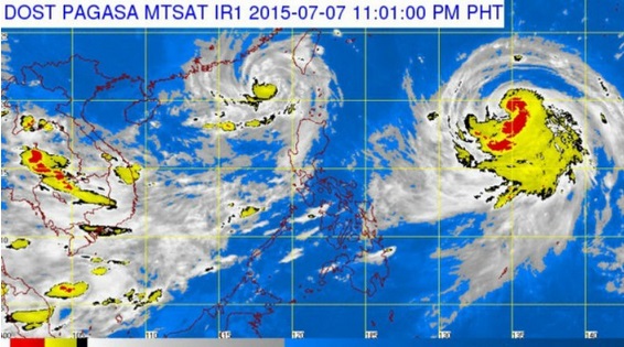
A stronger Typhoon “Falcon” (international name: Chan-hom) entered the Philippine area of responsibility (PAR) on Tuesday evening after Tropical Storm “Egay” (Linfa) had left for Taiwan just hours earlier.
BACKSTORY: ‘Egay’ exits PAR, but stronger typhoon nears | Tropical Storm ‘Falcon’ hot on heels of ‘Egay’
In its latest weather bulletin issued 11 p.m. Tuesday, the Philippine Atmospheric Geophysical and Astronomical Services Administration (Pagasa) said Falcon was tracked 1,400 kilometers east of Aparri , Cagayan, as of 10 p.m. Tuesday, packing maximum sustained winds of 130 kilometers per hour near the center and gusts of up to 160 kph.
Pagasa lifted all storm signals and gale warnings, but warned that typhoon-enhanced monsoon rains may trigger flash floods and landslides in the Ilocos, Cordillera and Mimaropa regions and the provinces of Bataan and Zambales.
Metro Manila and the rest of Central Luzon may expect only occasional rains while the rest of the country will have isolated thunderstorms, Pagasa said.
In a briefing, meteorologist Sam Duran said that while the rains will not be as heavy as those dumped by Egay over the weekend, the land is already saturated, so more rains may cause flash floods and landslides.
Falcon was forecast to move west northwest at a rather faster pace of 20 kph than that of Egay at 7-9 kph, so that by Friday evening it is expected to be 625 km northeast of Itbayat, Batanes, and out of the PAR.