


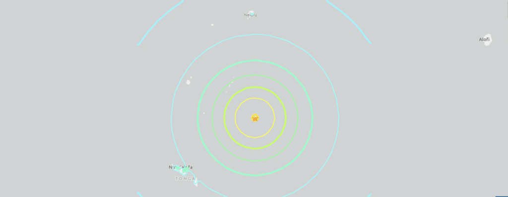
This is a screenshot of the interactive map of the United States Geological Service (USGS) showing the magnitude 7.0 earthquake that hit 73 kilometers southeast of Pangai, Tonga at 1219 GMT on Sunday, March 30. | USGS
SYDNEY, Australia — A 7.0-magnitude quake struck offshore near Tonga, the US Geological Survey said Sunday, with authorities in the Pacific island nation briefly issuing a tsunami warning before giving the all-clear.
The shallow quake hit 79 kilometres (49 miles) south-southeast of the village of Pangai at 1219 GMT on Sunday.
The US tsunami warning system initially said “hazardous tsunami waves from this earthquake are possible within 300 kilometres of the epicentre along the coasts of Tonga”.
READ:
Scientists explain why Myanmar earthquake was very deadly
EXPLAINER: Earthquake terms you need to know
Earthquake preparedness saves lives: What to do
It subsequently revised the assessment, saying “the tsunami threat from this earthquake has now passed”, but authorities in Tonga issued further warnings.
The Tonga Meteorological Services told residents in the risk area to evacuate inland to high ground, three-storey solid buildings or tsunami evacuation sites.
“Mariners out at sea are advised to move to deep water away from reefs or coasts and remain there until it is safe,” it said on Facebook, before later cancelling the advisory.
The tourism ministry published an evacuation map on Facebook for the capital Nuku’alofa.
Earthquakes are common in Tonga, a low-lying archipelago home to around 100,000 people that straddles the seismic Ring of Fire.
The Ring of Fire is an arc of intense tectonic activity that stretches through Southeast Asia and across the Pacific basin.