27 days without rain: Pagasa warns El Niño may hit by mid-2026
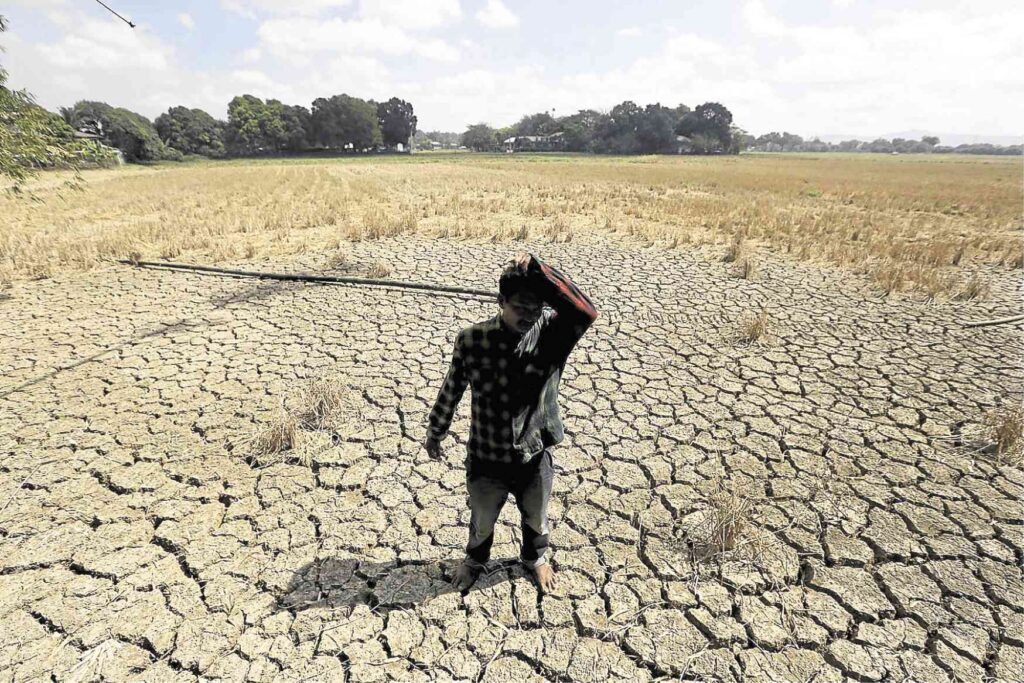
CEBU CITY, Philippines — After 27 consecutive days without rain, the state weather bureau is monitoring a possible shift to El Niño conditions by mid-2026, which could bring drier and hotter weather across the country.
Weather Specialist I Patrick Ian Taganas Plimaco of the Philippine Atmospheric, Geophysical and Astronomical Services Administration (Pagasa) said that as of April 22, the Philippines remains under ENSO-neutral conditions, meaning El Niño is not currently affecting the country’s climate.
However, he noted that the last recorded rainfall in Cebu was on March 27, marking 27 straight days without rain.
El Niño may develop midyear
Despite this dry spell, Pagasa forecasts that ENSO-neutral conditions will likely persist through the March-April-May (MAM) and May-June-July (MJJ) seasons before a likely transition.
Plimaco said there is a 79 percent probability that El Niño will develop between June and August 2026, with conditions potentially continuing into early 2027.
He added that the phenomenon may further intensify later in the year, with a 41 to 72 percent chance of reaching moderate to strong levels by September to October, and possibly strengthening to strong to very strong intensity during the October to December period.
Possible impacts
It also tends to raise temperatures as El Niño is typically associated with below-normal rainfall in several parts of the country, amplifying the already warm months.
“Possible impacts of El Niño sa atong country, it increases the likelihood of below-normal rainfall conditions sa ubang areas sa atong nasod and depending sa onset niya,” said Plimaco.
READ: Rice crisis looms: Super El Niño threatens PH supply in 2026
However, Pagasa emphasized that impacts may vary depending on the development of the phenomenon. In some cases, El Niño can enhance the southwest monsoon, which may still bring rainfall to the western sections of the country.
The weather bureau also noted a reduction in tropical cyclone (TC) activity within the Philippine Area of Responsibility (PAR), although storms that do form may develop farther east before entering the country.
“Ma reduce niya. Pero dili gihapon ingon na mawala, low chance and mu shift siya more sa east part sa PAR sa atong kadagatan,” said Plimaco.
(“The storms will be reduced. But they won’t be gone, just low chance, and they’re going to shift more toward the east part of our PAR in our seas.”)
READ: Pagasa issues El Niño Alert; drought in PH now likely
Disclaimer: The comments uploaded on this site do not necessarily represent or reflect the views of management and owner of Cebudailynews. We reserve the right to exclude comments that we deem to be inconsistent with our editorial standards.