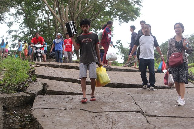
Landslides expose tension cracks affecting roads in Barangay Sirao, Cebu City, triggered by incessant rains. (CDN FILE PHOTO)
Residents of two sitios in the mountain barangay of Sirao in Cebu City were advised to evacuate following last Sunday’s landslide in the area.
In a statement sent to media outlets, the regional Mines and Geosciences Bureau (MGB-7) said the recurring landslide in Sitios Langub and Tawagan is caused by the “overly saturated ground” due to the rainfall.
Last March, a team of geologists from MGB-7 inspected the area and found tension cracks progressing laterally and vertically in Sitio Tawagan and in the slope of the Sirao Flower Garden.
The geologists also observed several ground craters, sinkholes, and fractured cave systems that indicate what they described as “active subsidence hazard.”
The bureau said they found 22 sinkholes within Mt. Kan-irag, Mt. Pung-ol and Mt. Balisong with a depth ranging from half meter to three meters and a a diameter of up to 250 meters.
“Areas declared as highly susceptible to subsidence and landslide should be free from permanent habitation. These areas may be designated for agro-forestry and other uses deemed appropriate by other agencies,” MGB geologist Liza Socorro Manzano said.
Nagiel Bañacia, Cebu City Disaster Risk Reduction Management Office (CCDRRMO) chief, said there were 40 structures that were determined at risk because of the continuous movement of the soil.
These also include the barangay hall and barangay gym of Sirao.
Bañacia said there were major landslides in Sirao in the years 1997, 2006, and January this year.
“They recommended a total evacuation of the area. I admit that it’s the most difficult to do. It’s not easy to evacuate these residents who have been living there for years,” he said.
Bañacia said the residents already know about the situation.
Bañacia said he will talk again to the residents after Holy Week.
He said some of the residents already vacated their houses and went to neighboring barangays to stay with their relatives./Reporter Nestle L. Semilla