
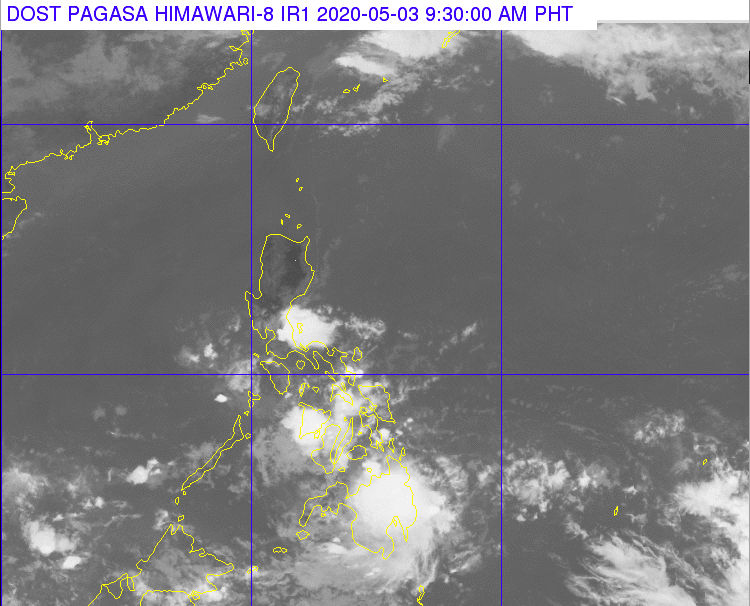
The 9:30 a.m. satellite image of DOST-Pagasa on the Low Pressure Area that is located east of Davao City and that is embedded along the Intertropical Convergence Zone (ITCZ) affecting Mindanao area.|Photo courtesy of DOST-Pagasa
CEBU CITY, Philippines — The state weather bureau has warned residents of risk areas in the Visayas and Mindanao of possible flash floods or landslides due to the rains brought by the Low Pressure Area (LPA) that is now affecting the regions.
In its 5 a.m. forecast on Sunday, May 3, 2020, the Philippine Atmospheric Geophysical and Astronomical Services Administration (Pagasa) estimated that the LPA about 400 kilometers east of Davao City.
The LPA was already about 280 kilometers east and northeast of Davao City as of 9 a.m. today.
“It is embedded along the Intertropical Convergence Zone (ITCZ) affecting Mindanao,” Pagasa said.
READ: Cebu Province expected to experience rain by May
Jhomer Eclarino of Pagasa Mactan said that scattered rain showers will be experienced in Central Visayas until Monday, May 4. Cebu and the rest of Central Visayas will already have clear skies on Tuesday.
Pagasa, however, said the chance for the LPA to develop into the country’s first tropical depression for the year remains low.
“Ang kini nga model possible mo traverse rest sa Mindanao and less lang iyang chance ma himog bagyo kay sa pag traverse ani mahilis lang kini,” said Eclarino.
(This model is expected to traverse to Mindanao but it has less chance of developing into a tropical depression because it is expected to dissipate.)
However, moderate to strong winds blowing east to northeast are expected in the seas of the Visayas and Mindanao because of the weather systems.
Coastal waters in these areas may also reach up to 2.8 meters high.
The LPA is expected to generally move west and bring rains in areas in Visayas and Mindanao. / dcb