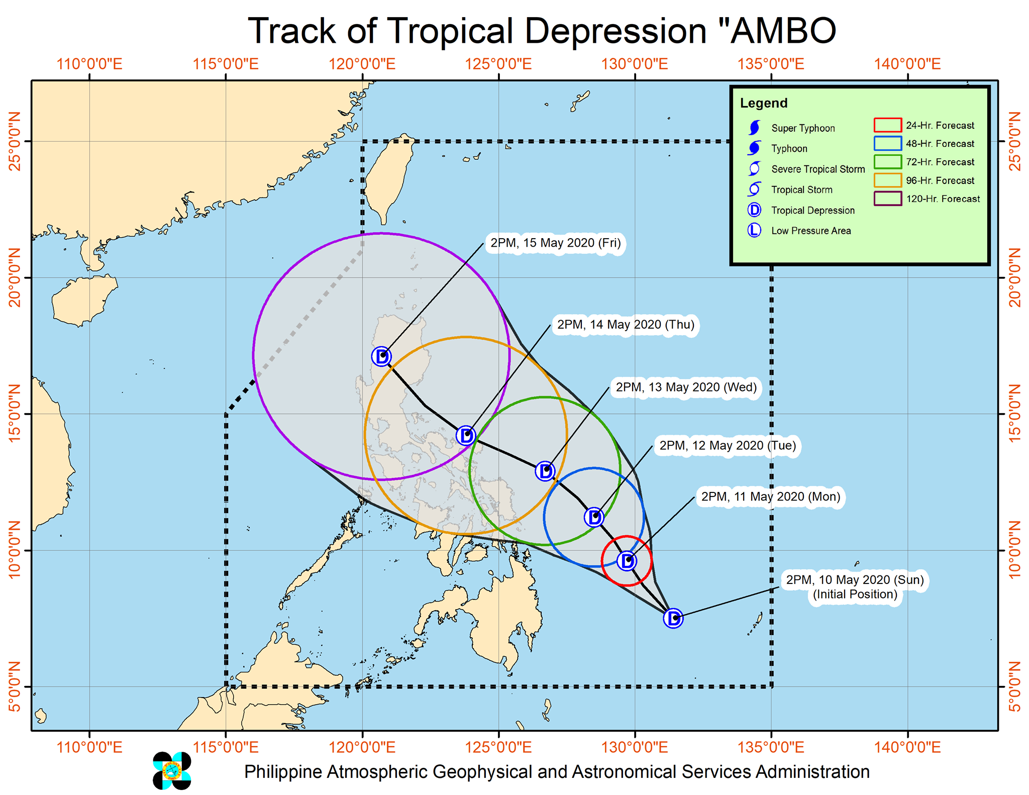
The forecast track of TD Ambo from May 10 to May 15, 2020.
CEBU CITY, Philippines — Visayas and Mindanao may take a break from the heat experienced in the past days as this year’s first typhoon is seen to bring rains here in the coming week.
At 2 p.m. on Sunday, May 10, the low pressure area (LPA) east of Mindanao has developed into a tropical depression while still at sea. It is given the name “Ambo.”
READ: LPA may develop into Tropical Depression Ambo
The center of Ambo was last estimated at about 545 kilometers east of Hinatuan, Surigao del Sur. At present, Ambo is maintaining the maximum sustained winds of 45 kilometers per hour and gustiness of up to 55 kph.
“In the next 24 hours, the trough of TD Ambo will bring scattered light to moderate with isolated heavy rains during thunderstorms over Caraga, Davao Region, SOCCSKSARGEN, and Maguindanao,” Pagasa said in its 5 p.m. advisory.
Jhomer Eclarino, weather specialist in Pagasa Mactan, said Ambo will less likely cross the Visayas based on their current forecast models. However, the trough of the tropical depression will still bring rains over Eastern Visayas and scattered rainshowers in Central Visayas.
At 6 p.m. this Sunday, Pagasa issued a thunderstorm advisory for Leyte province. Moderate to occasional heavy rainshowers with lightning and strong winds due to thunderstorms are affecting the towns of Alangalang, Santa Fe, Pastrana, and Jaro, which may last for about one to two hours and may affect nearby areas.
While its track is directed upwards, Eclarino said the tropical depression is likely to make a landfall somewhere in Luzon late next week.
TD Ambo is moving slowly in a west-northwest track at 15 kilometers per hour. Pagasa’s forecast track of the tropical depression suggests that Ambo will still be in the vicinity of the Luzon landmass by Friday, May 15.
Eclarino added that their present analysis shows a less likely chance that Ambo will further intensify into a tropical storm while it is inside the Philippine Area of Responsibility (PAR). / dcb