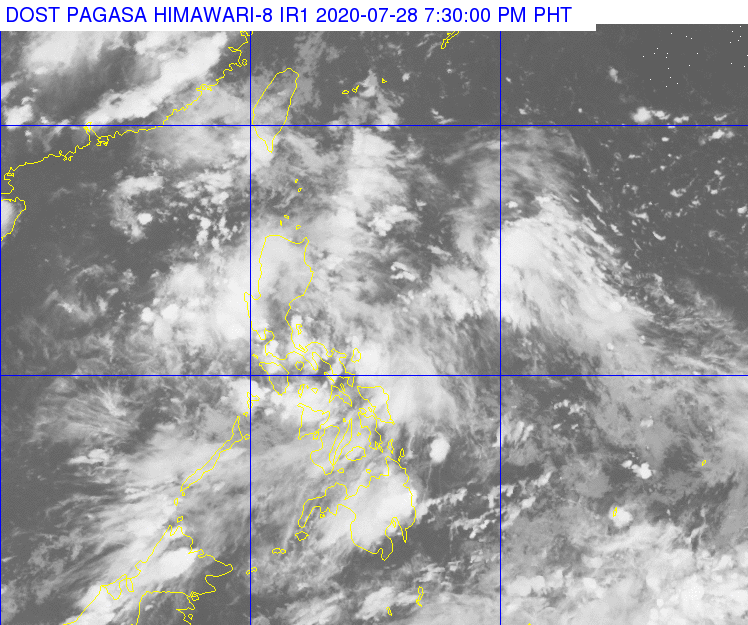
Satellite image of the Philippines of the Philippine Area of Responsibility as of 7:30 p.m. on July 28. (DOST HIMAWARI)
CEBU CITY, Philippines — The Philippine Atmospheric Geophysical and Astronomical Services Administration (Pagasa) warns residents in risk areas in the Visayas region to be vigilant for possible flooding and landslides as cloudy skies and rainshowers brought by the low pressure area (LPA) within the Philippine Area of Responsibility (PAR) are likely to stay at least for the next three or four days.
On Tuesday, July 28, 2020, scattered rains were experienced over Metro Cebu.
The Mactan Station of Pagasa has issued rainfall and thunderstorm advisories over Palawan, Eastern, Central and Western Visayas throughout the day.
At 6:14 p.m. Pagasa hoisted a yellow rainfall alert over central Cebu, which indicates that rainfall volume may induce flooding in low-lying areas and landslides in the hinterlands.
“We remind the entire Visayas to be vigilant because flooding and landslides are really possible especially since the soil may already be saturated from the downpours in the past days,” Pagasa Mactan Weather Specialist Joseph Merlas told CDN Digital.
As of 3 p.m., the LPA that is causing the wet weather was located some 65 kilometers east northeast of Virac, Catanduanes
Merlas said there is less chance that the LPA will intensify into a tropical depression within the next two days.
“Cloudy gihapon ta ug naa gihapon tay scattered rainshowers in the next 24 hours o ugma, mao gihapon naa gihapoy taas nga chances of rainfall,” he said.
(It will still be cloudy with scattered rainshowers in the next 25 hours or tomorrow, it will still be the same, we will still have high chances of rainfall.)
Aside from the LPA, the Southwest monsoon or Habagat that had been intensified by the LPA, also contributes to the rainfall and cloudiness in the region, Merlas said. /bmjo
Read: Why is illegal drugs still a problem in Central Visayas despite pandemic?

