
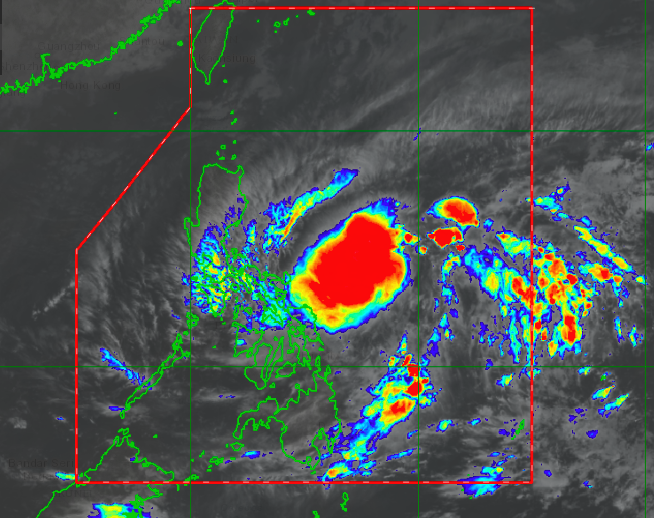
TD Amang as of 6 a.m. | Pagasa
The Low Pressure Area (LPA) spotted east of Catanduanes has developed into Tropical Depression “Amang” at 2 a.m. on Tuesday, April 11, 2023.
In its latest weather update issued at 5 a.m., the center of TD “Amang” was estimated, based on all available data, at 495 kilometers east of Virac, Catanduanes.

TD Amang brings maximum sustained winds of 45 km/h near the center and gustiness of up to 55 km/h. It is moving west northwestward at 20 km/h.
The topical depression is expected to bring rains and gusty winds to Northern and Eastern Samar.
Central Visayas and the rest of Eastern Visayas will also have cloudy skies with scattered rainshowers and thunderstorms due to TD “Amang.”
The rest of Visayas, Palawan including Kalayaan Islands, and Occidental Mindoro will have partly cloudy to cloudy skies with isolated rainshowers or thunderstorms, according to the 5 a.m bulletin.
Pagasa also issued a rainfall advisory at 5 a.m.

In the advisory, it said light to moderate with occasional heavy (2.5-4.5 with occasional 7.5-15 liters/meter² per hour) rains will affect the northern portion of Samar, which may continue for 2-3 hours and may affect nearby areas.
“The public and the disaster risk reduction and management council concerned are advised to monitor the weather condition,” the advisory read.
The next advisory will be issued at 8 a.m.
READ MORE:
LPA to bring rain over parts of PH on Tuesday — Pagasa