


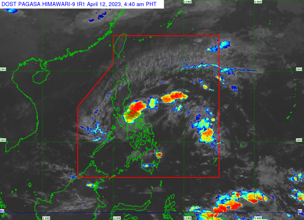
TD Amang as of 4 a.m. Wednesday, April 12, 2023. | Pagasa
Tropical depression #AmangPH, the Philippines’ first tropical cyclone for 2023, has slowed down.
As of 4 a.m. on Wednesday, April 12, the center of Tropical Depression Amang was estimated to be over the coastal waters of San Andres, Catanduanes, according to a bulletin posted by the Philippine Atmospheric, Geophysical and Astronomical Services Administration (Pagasa) at 5 a.m.

Amang has maximum sustained winds of 45 km/h near the center, gustiness of up to 60 km/h, and central pressure of 1006 hPa.
Tropical Cyclone wind signal no. 1 was still in effect in this areas:
Luzon
Catanduanes, Sorsogon, Albay, Camarines Sur, Camarines Norte, Ticao Island, Burias Island, the eastern portion of Laguna (San Pablo City, Rizal, Nagcarlan, Pila, Liliw, Magdalena, Majayjay, Luisiana, Cavinti, Pagsanjan, Santa Cruz, Lumban, Kalayaan, Paete, Pakil, Pangil, Siniloan, Famy, Santa Maria, Mabitac), Aurora, Quezon, and the eastern portion of Rizal (Tanay, Pililla, Jala-Jala).
Areas under Wind Signal No. 1 may experience strong winds (strong breeze to near gale strength) associated with the tropical depression which may cause minimal to minor impacts to life and property, Pagasa says in its bulletin.
The tropical depression is forecast to move generally westward or west northwestward in the next 24 hours, which will bring its center over the Camarines Provinces, Lamon Bay, and mainland Quezon with the possibility of passing near or over Polillo Islands.
Considering the weak and disorganized nature of this depression, northward or southward shifts in the track forecast of succeeding bulletins are not ruled out.
The tropical depression is forecast to weaken into a low pressure area by tomorrow, possibly earlier, due to the combined effects of land interaction, dry air intrusion, and increasing vertical wind shear, Pagasa’s bulletin added.

READ MORE:
Live Updates: Tropical Depression Amang