
Track of Betty from Live Update
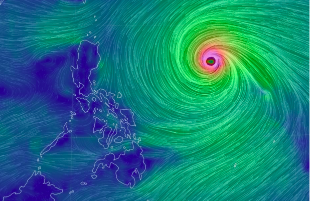
MANILA, Philippines — The Philippine Atmospheric, Geophysical and Astronomical Services Administration said on Saturday morning that it may raise gale warnings over the eastern seaboards of Luzon, Visayas, and Mindanao as Super Typhoon Betty is seen to bring about turbulent waves in these regions.
“In the next 24 hours, the eastern seaboards of Luzon and Visayas will experience moderate to rough (1.5 to 3.5 m) seas, which may become rough to very rough (2.5 to 5.0 m),” Pagasa’s tropical cyclone bulletin states.
“The northern seaboard of Luzon may also experience moderate to rough seas (1.5 to 3.0 m) this morning through the afternoon and rough seas (2.5 to 4.0 m) beginning tonight,” it also says.
READ: Betty to bring strong wind, rain over northern Luzon during its ‘crucial’ days – Pagasa
Because of this forecast, the state weather bureau advised fishers and small seacraft mariners to avoid setting sail in these stormy sea conditions.
Pagasa maintained that Betty will have no direct effect on the country as it is unlikely to make landfall. However, the super typhoon will enhance the southwest monsoon (locally known as habagat) which may bring about rain, especially in Mimaropa, Visayas, and Mindanao, by Sunday.
RELATED STORIES
Super Typhoon Betty enters PAR
Super Typhoon Betty – latest updates
Super Typhoon Mawar may whip up monsoon rain in Luzon, Visayas next week
kga