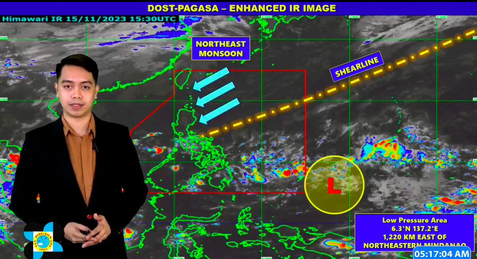
Weather specialist Patrick Del Mundo reports for Pagasa on Thursday, November 16, 2023. | screengrab from Pagasa
The low-pressure area (LPA) east of northeastern Mindanao still has little chance of developing into a storm on Thursday, November 16, 2023, according to the latest Pagasa report.
In a public weather forecast issued at 4 a.m. on Thursday, Pagasa said the LPA remains outside the Philippine Area of Responsibility (PAR) at 1,220 kilometers east of northeastern Mindanao.
“Itong low-pressure area na ito, sa ngayon, ay mas bumaba ang tsansa na magiging bagyo sa mga susunod na mga oras. Inaasahan natin na mananatiling mababa yung tsansa nito na magiging bagyo within the next 48 hours,” weather specialist Patrick Del Mundo said in his report.
(This low-pressure area, for now, has a slim chance of becoming a storm in the next couple of hours. It is expected that the chances of becoming a storm will remain slim within the next 48 hours.)
Del Mundo said the LPA is expected to enter the PAR in the next 24 hours.
Whether it becomes a storm or not, the LPA is still expected to bring rains, especially in the Bicol region, Eastern Visayas, and Caraga region by Sunday.
For now, the northeastern monsoon, or hanging amihan, is affecting parts of Luzon while the shear line is also affecting Southern Luzon and the Eastern Visayas area.
Beware of fake weather news
Pagasa encourages the public to monitor weather from its official pages.
Pagasa Mactan, meanwhile, urged the public to exercise caution in sharing unverified and fake weather updates amid threats of inclement weather
Pagasa-Mactan confirmed receiving reports of posts circulating on social media about a ‘strong typhoon’ that will pass through the Visayas this week
READ MORE: Cebu City prepares for possible weather disturbance this week