
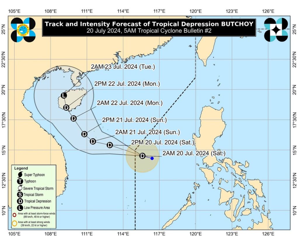
The estimated track of Tropical Depression Butchoy until Tuesday, July 23. | DOST-Pagasa
CEBU CITY, Philippines —Based on its 5am bulletin, Pagasa said the center of Tropical Depression Butchoy was estimated based on all available data at 545 km West of Subic Bay, Zambales.
It has maximum sustained winds of 55 km/h near the center, gustiness of up to 70 km/h, and moving west northwestward at 20 km/h. #TDButchoy still packs strong winds that extend outwards up to 150 km from the center.
The state weather bureau added that TD #Butchoy is unlikely to directly affect the country within the next three days and there are no wind signals hoisted all over the country.
READ:
LIVE UPDATES: Tropical depressions Butchoy, Carina
Tropical Depression “Butchoy”
Pagasa however, said, that the Southwest Monsoon or Habagat that is being enhanced alongside Tropical Depression Carina will bring moderate to heavy rains over the western portion of Luzon over the next three days.
The Southwest Monsoon that will be enhanced by #TDButchoy and #TDCarina will bring gusty conditions over the following areas (especially in coastal and upland areas exposed to winds) today and tomorrow (Sunday): Kalayaan Islands while on Monday, gusty conditions will be experienced in Calabarzon, MIMAROPA, Bicol Region, Western Visayas, Bataan, and Metro Manila.
Pagasa added that in the next 24 hours, the Southwest Monsoon enhanced by BUTCHOY will bring slight to moderate seas (0.5-2.0 m) over the coastal waters of Ilocos Region, Zambales, Bataan, Occidental Mindoro, and the northern portion of Palawan including Calamian (west coast) and Kalayaan Islands.
Mariners of motor bancas and similarly-sized vessels are advised to take precautionary measures while venturing out to sea.
#TDButchoy is expected to make landfall over Hainan, China on Monday, July 22.
The next tropical cyclone bulletin will be issued at 11:00 AM today.