
Earth nullschool
CEBU CITY, Philippines – Carina (international name Gaemi) on Wednesday, July 24, has intensified into a super typhoon hours after bringing intense rains and severe floodings in Metro Manila.
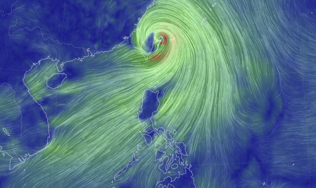
At 4:55 p.m., the state weather bureau announced that Carina developed into a super typhoon as it made its way to northern Taiwan where it is expected to make another landfall.
READ: LIVE UPDATES: Super Typhoon Carina
As a result, he Philippine Atmospheric Geophysical and Astronomical Services Administration (Pagasa) raised Tropical Cyclone Wind Signal (TCWS) No. 2 in Batanes.

TCWS No. 1 were also raised in Babuyan Islands, the northern portion of mainland Cagayan (Claveria, Santa Praxedes, Sanchez-Mira, Pamplona, Abulug, Ballesteros, Aparri, Camalaniugan, Buguey, Santa Teresita, Santa Ana, Gonzaga), and the northern portion of Ilocos Norte (Burgos, Bangui, Pagudpud, Dumalneg, Adams).
Carina currently packs winds with speed of up 185 kilometers per hour near the center, gustiness of up to 230 kilometers per hour.

The super typhoon was last spotted 380 kilometers North of Itbayat, Batanes as of 4:00 p.m., moving at a northwestward direction with a speed of 20 kilometers per hour.
Strong to typhoon-force winds are also expected outwards up to 700 kilometer from the center of the typhoon, Pagasa added.
Relentless rain drenched the northern Philippines, triggering floods in Manila and landslides in mountainous regions as Carina intensified the seasonal monsoon.
In the densely populated capital, rescuers were deployed across the city to help evacuate people from low-lying homes after downpours turned streets into rivers, trapping vehicles.
Meanwhile, in Cebu, several passengers have been left stranded at the Mactan-Cebu International Airport (MCIA) following flight cancellations and delays due to Carina. / with reports from Agence France-Presse
