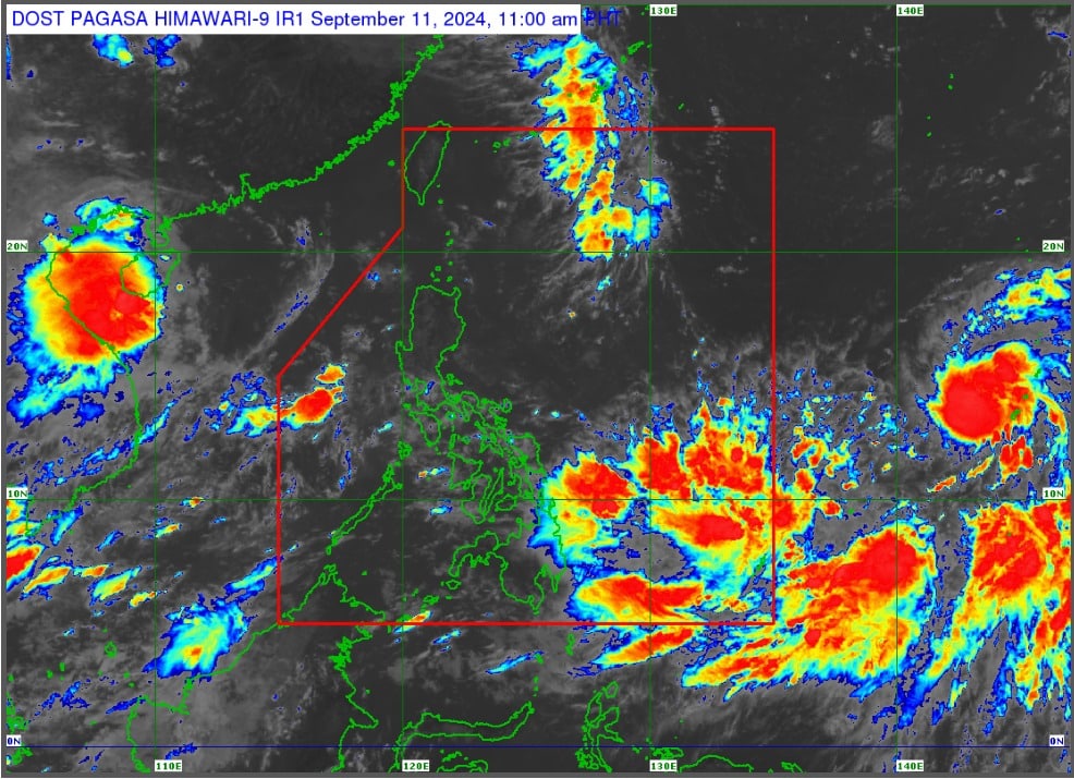
Satellite image of Tropical Storm Bebinca (international name) as of Wednesday, September 11, 2024.
CEBU CITY, Philippines — Tropical Storm Bebinca may not directly impact the Philippines once it enters the Philippine Area of Responsibility (PAR).
But many parts of the country, including Cebu, may likely have a damp weekend as Bebinca will enhance the prevailing southwest monsoon (habagat).
READ MORE
EXPLAINER: What do color-coded rainfall warnings mean?
Tropical depression intensifies into tropical storm Bebinca outside PAR
Tropical Storm Enteng: 10 confirmed dead – NDRRMC
Based on the latest advisory from the Philippine Atmospheric, Geophysical, and Astronomical Services Administration (Pagasa), Bebinca is “forecasted to intensify into a severe tropical storm within 24 hours and may reach typhoon category on late Thursday (September 12).”
Present models from the state weather bureau showed that Bebinca may not make a landfall in any part of the Philippines.
Instead, it will likely just pass by the country via the Philippine Sea, said Everjohn Penio, weather specialist at Pagasa-Mactan.
“Gamay ang chansa na maigo sa asa mang bahin sa Pilipinas pero iyahang baybayon ang northeastern nga bahin sa Philippine Area of Responsibility,” said Penio.
(There’s little chance that any part of the Philippines will be hit but it traverse the northeastern part of the Philippine Area of Responsibility.)
READ MORE: Pagasa to use AI in weather forecasting soon
However, Pagasa-Mactan cautioned the public to be prepared for bad weather beginning Thursday until weekend.
According to state meteorologists, Bebinca may strengthen the habagat and therefore will bring heavy rainfall and strong wind.
“Possible ang kusog nga uwan and hangin. Possible sad makaissue og gale warning,” Penio added.
(Heavy rains and strong winds may be possible. It is also possible that a gale warning may be issued.)
Bebinca was last spotted 1,955 kilometers east of Southern Luzon, packing winds of up to 85 kilometers per hour (kph) and gusts of up to 105 kph.
It is moving westward at a speed of 25 km/h.
Bebinca may enter PAR within Friday, September 13th.