


earth.nullschool
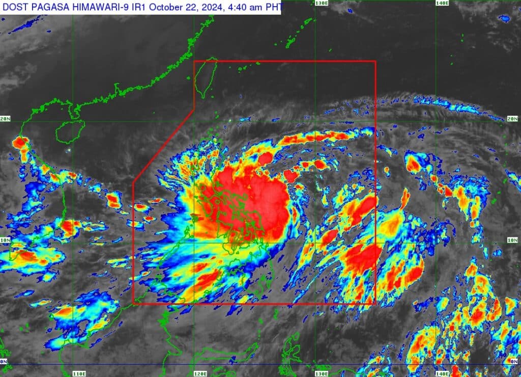
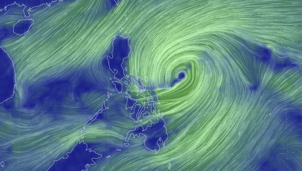
Tropical Storm Kristine, ( international name TRAMI), has intensified into a tropical storm based on 5 a.m. bulletin from Pagasa on Tuesday, October 22, 2024.
Kristine now packs maximum sustained winds of 65 kilometers per hour (km/h) near the center, gustiness of up to 80 km/h, and central pressure of 994 hPa, Pagasa said in its bulletin.
READ MORE:
Tropical storm Kristine: LIVE UPDATES
The location of the center of the storm at 4 a.m. was estimated to be at 390 km East of Virac, Catanduanes. Kristine is moving westward at 15 km/h.
TROPICAL CYCLONE WIND SIGNALS (TCWS) IN EFFECT
Kristine: Signal No. 1
Luzon
The eastern and central portions of mainland Cagayan (Piat, Santo Nino, Camalaniugan, Tuao, Lal-Lo, Enrile, Gonzaga, Alcala, Amulung, Santa Teresita, Baggao, Buguey, Solana, Rizal, Santa Ana, Tuguegarao City, Gattaran, Peñablanca, Iguig, Lasam, Aparri, Allacapan), Isabela, Quirino, the southern portion of Nueva Vizcaya (Alfonso Castañeda), Aurora, the eastern portion of Rizal (Tanay, Pililla, Jala-Jala), the eastern portion of Laguna (Majayjay, Magdalena, Pila, Santa Cruz, Pagsanjan, Luisiana, Cavinti, Lumban, Kalayaan, Paete, Pakil, Pangil, Siniloan, Famy, Santa Maria, Mabitac, Nagcarlan, Liliw), the northern and eastern portions of Quezon (Tagkawayan, Guinayangan, Buenavista, San Narciso, San Andres, General Nakar, Pitogo, San Francisco, Calauag, Pagbilao, Infanta, Lopez, Catanauan, Mulanay, Unisan, General Luna, Plaridel, Quezon, Alabat, Sampaloc, Padre Burgos, Macalelon, Mauban, Perez, Agdangan, Gumaca, Atimonan, Real, Lucena City, Lucban, City of Tayabas) including Polillo Islands, Marinduque, Romblon, Camarines Norte, Camarines Sur, Catanduanes, Albay, Sorsogon, and Masbate including Ticao Island and Burias Island
Visayas
Eastern Samar, Northern Samar, Samar, Leyte, Biliran, and Southern Leyte
Mindanao
Dinagat Islands and Surigao del Norte including Siargao – Bucas Grande Group
Kristine is forecast to move northwestward to west northwestward until Thursday, October 24, before turning westward for the rest of the forecast period.
On the track forecast, this tropical cyclone may make landfall over Isabela Wednesday evening, October 23, and may exit the Philippine Area of Responsibility by Friday evening, October 25.