
| Pagasa photo
Another low pressure area (LPA) has developed outside the Philippine Area of Responsibility (PAR), Pagasa said in its latest report.
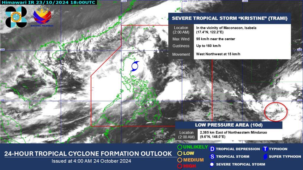
According to Weather Specialist Benison Estareja, the LPA is around 2,400 kilometers east of northeastern Mindanao as of 2 a.m. Thursday morning, October 24.

Estareja said there is a high chance that in the next 24 hours, this LPA will develop into a tropical depression.
He said, though, that in the next three days, it won’t have any direct effect on the country.
Estareja said the LPA may enter the PAR early next week.
READ MORE:
Kristine update: Signal No. 1 remains in northern parts of Cebu
Meanwhile, the center of severe tropical storm Kristine, as of 4 a.m. on Thursday, was estimated in the vicinity of Tumauini, Isabela, packing maximum sustained winds of 95 km/h near the center, gustiness of up to 160 km/h, and central pressure of 985 hPa.
Kristine is moving west northwestward at 15 km/h.
Kristine is forecast to cross northern Luzon over the next 12 hours and may emerge over the waters west of Ilocos Region Thursday afternoon or evening.
It will then move west northwestward over the West Philippine Sea and exit the Philippine Area of Responsibility (PAR) region on Friday afternoon, October 25.