
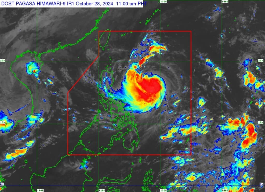
Satellite image of Leon. | Pagasa image
Pagasa, in its latest bulletin on Monday, October 28, 2024, sais said #LeonPH (International name: KONG-REY), has intensified into a severe tropical storm.
As of 10 a.m. on Monday, the center of severe tropical storm Leon was estimated at 735 kilometers east of Casiguran, Aurora, or 780 km east of Echague, Isabela.
READ MORE:
Kristine death toll rises to 110, says national disaster agency
Leon packs maximum sustained winds of 95 km/h near the center, gustiness of up to 115 km/h, and central pressure of 985 hPa. It is moving westward at 20 km/h.
TROPICAL CYCLONE WIND SIGNALS (TCWS) IN EFFECT
Leon: Signal No. 1
Luzon
Batanes, Cagayan including Babuyan Islands, Isabela, Ilocos Norte, Abra, Apayao, Kalinga, the eastern portion of Mountain Province (Natonin, Paracelis), the eastern portion of Ifugao (Aguinaldo, Alfonso Lista), the eastern portion of Quirino (Maddela), the northern portion of Aurora (Dilasag, Casiguran, Dinalungan), and the northern portion of Catanduanes (Pandan, Bagamanoc, Panganiban, Viga, Gigmoto)
Pagasa said the highest Wind Signal which may be hoisted during the occurrence of Leon is Signal No. 3 or 4, especially in extreme northern Luzon.
LEON: TRACK AND INTENSITY OUTLOOK
Leon is forecast to move west northwestward today through Tuesday morning, October 29, then turn northwestward until it makes landfall along the eastern coast of Taiwan on Thursday evening, October 31, or Friday morning, November 1.
After crossing the landmass of Taiwan, Leon will then turn to the northeast towards the East China Sea and exit the Philippine Area of Responsibility on Friday morning or afternoon.