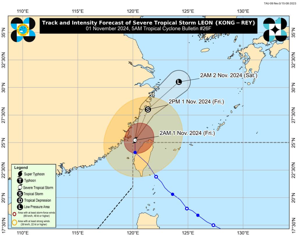
MANILA, Philippines – Leon (international name: Kong-rey) has exited the Philippine area of responsibility (PAR) and has weakened from a typhoon to a severe tropical storm early Friday morning, November 1. That is according to the state weather bureau
Leon was last located some 550 kilometers (km) north – northwest of Itbayat, Batanes, with a maximum wind speed of 100 kilometers per hour (kph) near the center, gusts of up to 140 kph and moving north at 20 kph, said Philippine Atmospheric, Geophysical and Astronomical Services Administration (Pagasa) in its 5 a.m. weather bulletin.
READ MORE:
Kong-rey among biggest typhoons to hit Taiwan in decades
Leon leaves trail of damage in Batanes
Strong winds, however, are still expected in parts of Northern Luzon.
“The wind flow coming towards the circulation of Leon will also bring gusty conditions (strong to gale-force) over the following localities (especially in coastal and upland areas exposed to winds) outside Wind Signal areas: Batanes, Babuyan Islands, northeastern mainland Cagayan, and eastern Isabela,” Pagasa warned.
Rough sea conditions are likewise expected in the said areas, Pagasa added.
Cloudy skies and scattered rain showers and thunderstorms due trough of the storm are expected in Occidental Mindoro, Zambales, Palawan and Bataan.
Partly cloudy skies and isolated rain showers and thunderstorms are forecast in Metro Manila and the rest of the country.