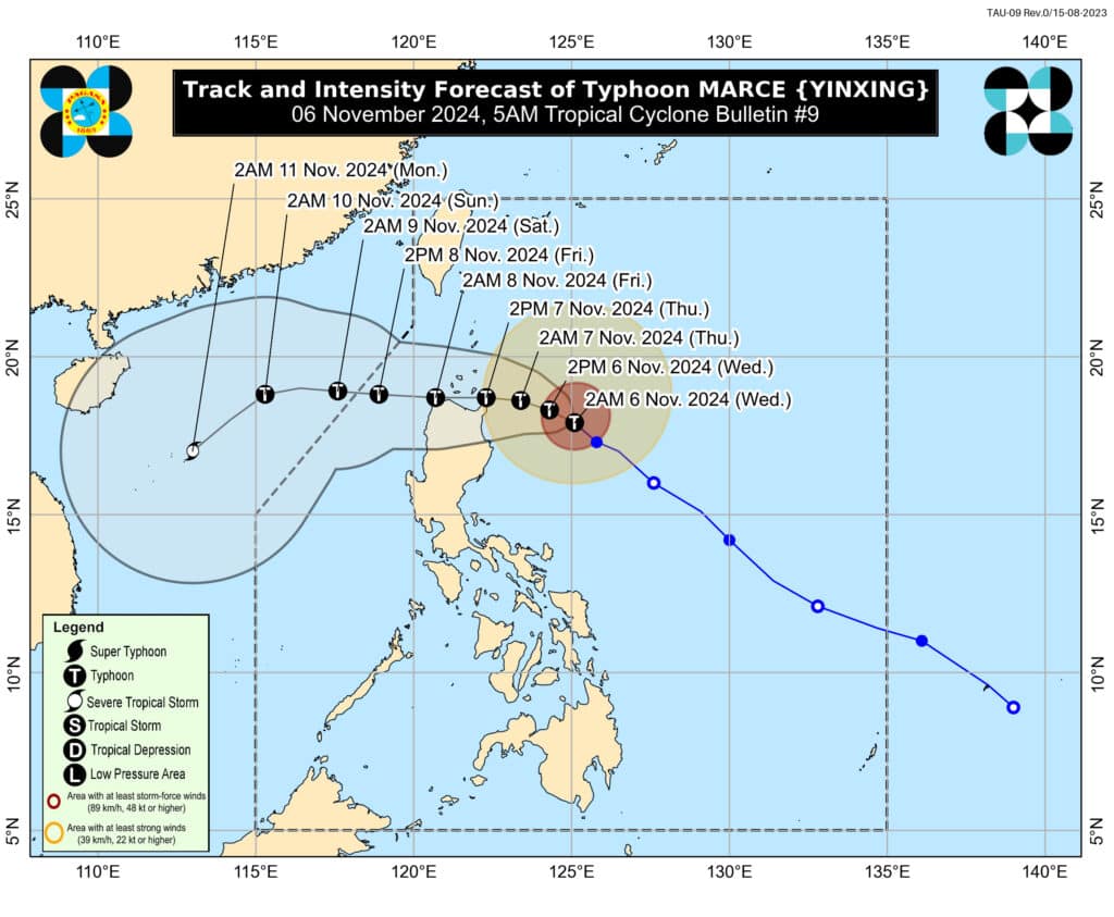
Storm track of typhoon Marce at 5 a.m., November 6. Pagasa
MANILA, Philippines — The state weather bureau said in its latest update that Typhoon Marce (international name: Yinxing) had maintained its strength as it moved over the Philippine Sea.
In a 5 a.m. bulletin on Thursday, Philippine Atmospheric, Geophysical and Astronomical Services Administration (Pagasa) said Marce was last spotted some 345 kilometers east of Tuguegarao City, Cagayan.
READ MORE:
Typhoon Marce may intensify before landfall on Thursday – Pagasa
It is now moving northwestward at 15 kilometers per hour (kph), packing maximum sustained winds of 140 kph near its center and a gustiness of up to 170 kph.
Pagasa hoisted Tropical Cyclone Wind Signal (TCWS) No. 2 in the following areas:
Eastern portion of Babuyan islands (Camiguin Island, Babuyan Island)
Northeastern portion of mainland Cagayan (Santa Ana, Gonzaga, Lal-Lo, Santa Teresita, Buguey)
Meanwhile, the following areas are placed under TCWS No. 1:
- Batanes
The rest of Cagayan including Babuyan Islands
Ilocos Norte
Ilocos Sur
Apayao
Abra
Kalinga
Mountain Province
Ifugao
Northern portion of Benguet (Mankayan, Buguias, Kabayan, Bakun, Kibungan, Atok, Bokod)
Isabela
Nueva Vizcaya
Quirino
Northern portion of Aurora (Dilasag, Casiguran, Dinalungan, Dipaculao, Baler, Maria Aurora)
Winds ranging from 39 to 61 kph may be expected in areas placed under TCWS No. 1.
“Marce is expected to continue intensifying and may reach its peak intensity today before it makes landfall or pass close to Babuyan Islands or Cagayan tomorrow (November 7),” Pagasa said in its morning bulletin.
It added that the typhoon may exit the Philippine Area of Responsibility on Friday evening.
READ: Pagasa releases 11 pm update on Typhoon Marce
In light of these developments, the state weather bureau advised the public and disaster risk reduction and management offices to take all necessary precautions to safeguard lives and property.
Pagasa also hoisted a gale warning over the seaboards of Northern Luzon and the eastern seaboard of Central Luzon.