

Source: DOST / Pagasa
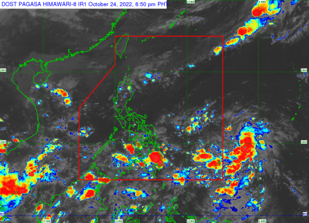
MANILA, Philippines — A low pressure area (LPA) being monitored east of Visayas may escalate into a tropical depression within the next 48 hours, said the Philippine Atmospheric, Geophysical and Astronomical Services Administration (Pagasa) on Monday.
According to Pagasa weather specialist Grace Castañeda in Pagasa’s latest weather advisory, the LPA was last spotted 995 east of Visayas.
“Itong low pressure area na ito sa kasalukuyan ay wala pa itong direct effects sa ating bansa, ngunit meron itong posibilidad na magdevelop at maging isang bagyo within the next 48 hours,” she said.
(This low pressure area currently has no direct effects on our country, but it has the possibility of developing and becoming a storm within the next 48 hours.)
She also noted that the LPA may make landfall in the country’s land mass, depending on its track in the next following days.
“Medyo mataas pa ang uncertainty at posible pa ang malaking pagbabago, pero nakikita natin ang posibilidad na starting Wednesday posible na magdulot ang trough nito ng mga pagulan sa bahagi ng Visayas at Southern Luzon,” she said.
(Uncertainty is still quite high and big changes are still possible, but we see the possibility that starting Wednesday it is possible that its trough will cause rains in parts of the Visayas and Southern Luzon.)
Meanwhile, rain will continue in parts of Northern Luzon, specifically, Ilocos Norte, Cagayan Apayao, Isabela, and Batanes due to the effects of the northeast monsoon, locally known as “amihan.”
The rest of Luzon, on the other hand, including Metro Manila, will have slightly cloudy to cloudy skies with isolated rain showers due to localized thunderstorms.
Scattered rain showers are then forecast over parts of Central and Eastern Visayas, as well as Caraga Region, while the rest of Visayas and Mindanao will have fairer weather with chances of isolated thunderstorms.
Due to the effects of amihan, gale warning is raised over Batanes, Cagayan (including Babuyan Islands), Ilocos Norte and Ilocos Sur.
The state weather service said the temperature range in key cities/areas across the country for Tuesday will be:
- Metro Manila: 25 to 33 degrees Celsius
- Baguio City: 16 to 24 degrees Celsius
- Laoag City: 24 to 31 degrees Celsius
- Tuguegarao: 23 to 30 degrees Celsius
- Legazpi City: 25 to 32 degrees Celsius
- Puerto Princesa City: 25 to 32 degrees Celsius
- Tagaytay: 23 to 30 degrees Celsius
- Kalayaan Islands: 26 to 32 degrees Celsius
- Iloilo City: 26 to 32 degrees Celsius
- Cebu: 25 to 31 degrees Celsius
- Tacloban City: 26 to 31 degrees Celsius
- Cagayan De Oro City: 24 to 31 degrees Celsius
- Zamboanga City: 24 to 33 degrees Celsius
- Davao City: 25 to 33 degrees Celsius
RELATED STORIES
ITCZ to bring rain over Visayas, Mindanao — Pagasa
LPA east of Luzon intensifies into a tropical depression
Cebu City on blue alert status due to LPA